Toggle navigation
Mountains
Routes
Images
Trip Reports
Forum
What's New
People
Areas & Ranges
Articles
Trailheads
Canyons
Huts & Campgrounds
Albums
Logistical Centers
Fact Sheets
Lists
Custom Objects
Gear
Plans & Partners
WELCOME TO SUMMITPOST
SIGN IN
REGISTER
Morton Peak
Additional Parents
Image
Morton Peak
View High-Resolution Image
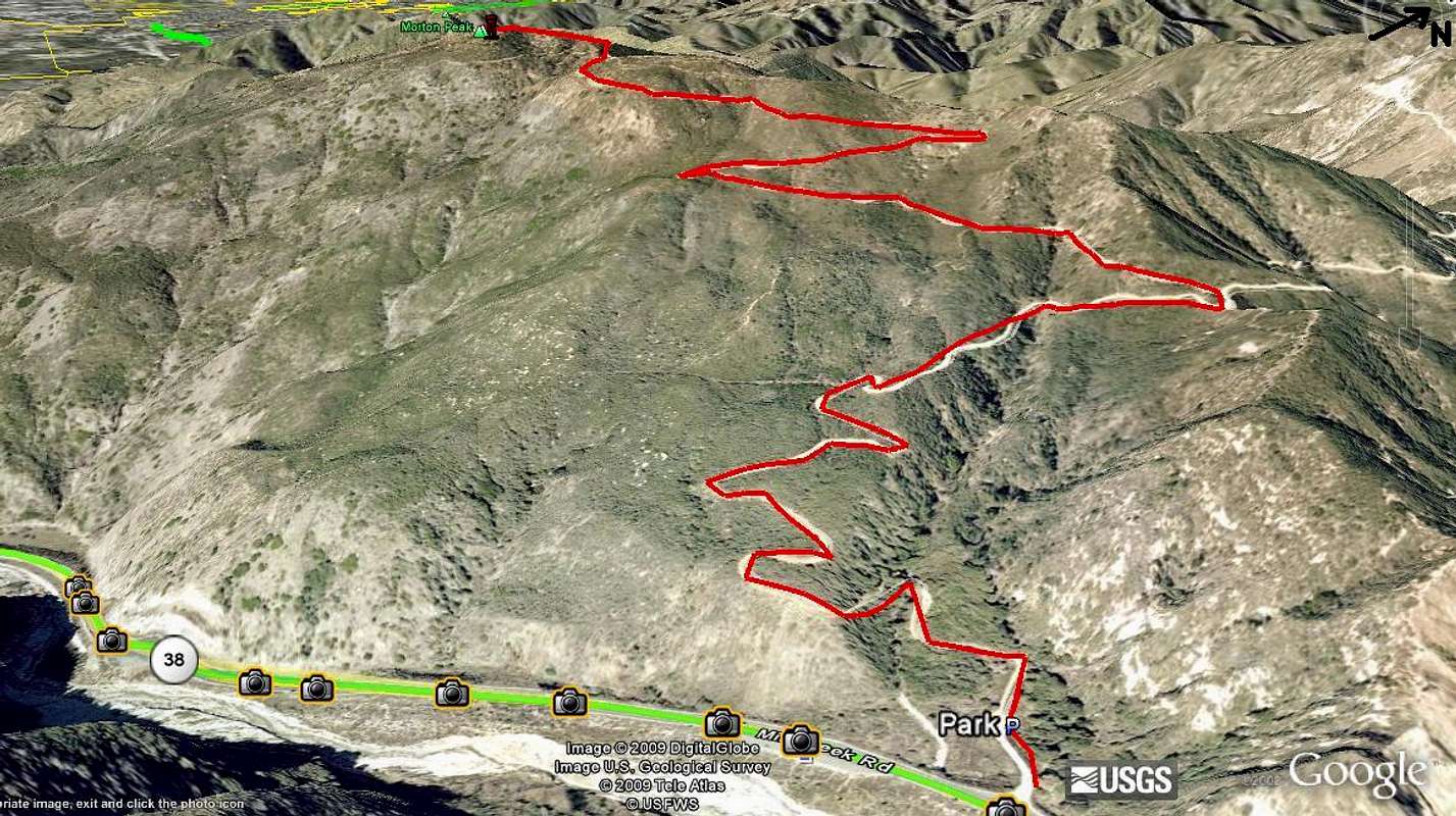
Morton Peak
Google Earth map of the fire road that goes up to the peak. 4,600 ft 3 miles from parking lot. Can drive up on fire road, but there is a gate. Sometimes it is open. About 3 hours to hike up and down.
« PREV
NEXT »
straydog5
on
Feb 28, 2009 4:25 pm
Comments & voting
Other parents
Lat/Lon:
34.10285°N / 117.03898°W
Image Type(s):
Informational
Image ID:
493770
1347 Hits
0
% Score
0
Votes
Log in to vote
Comments
No comments posted yet.
to post!
Don't have an account?
Morton Peak
(Album)
« PREV
Viewing
#10 of 10
GALLERY
You are at
the Last
Image
straydog5's Image Gallery
« PREV
Viewing
#198 of 199
GALLERY
NEXT »
×
You need to login in order to vote!
User Name
Password
Remember me
Forgot your password?
Log me out when I close my browser.
Keep me logged in all the time.
sign in as a user
Don't have an account?
Register now for FREE
Rating available
Suggested routes for you
People who climb the same things as you
Comments Available
Create Albums
Register Here


