Toggle navigation
Mountains
Routes
Images
Trip Reports
Forum
What's New
People
Areas & Ranges
Articles
Trailheads
Canyons
Huts & Campgrounds
Albums
Logistical Centers
Fact Sheets
Lists
Custom Objects
Gear
Plans & Partners
WELCOME TO SUMMITPOST
SIGN IN
REGISTER
Mount Langley
Additional Parents
Image
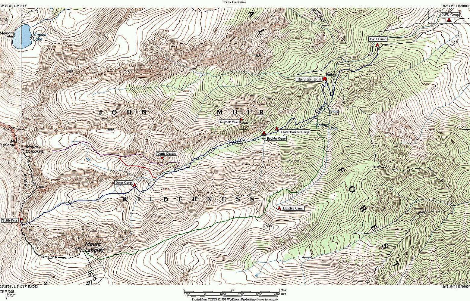
Map of Tuttle Creek drainage,...
View High-Resolution Image
Map of Tuttle Creek drainage,...
Map of Tuttle Creek drainage, with various routes traced, including the East Ridge of Mount Langley. A larger (readable) version of this map is located
here
.
NOTE: This image is a larger version of the previously posted image.
« PREV
NEXT »
Tom Kenney
on
Aug 14, 2002 12:18 pm
Comments & voting
Other parents
Lat/Lon:
36.52330°N / 118.238°W
Image Type(s):
Hiking
,
Topo/Diagram
,
Informational
Image ID:
9848
5693 Hits
69.88
% Score
1
Votes
Log in to vote
Comments
No comments posted yet.
to post!
Don't have an account?
Mount Langley
(Mountain/Rock)
« PREV
Viewing
#250 of 277
GALLERY
NEXT »
Tom Kenney's Image Gallery
« PREV
Viewing
#292 of 316
GALLERY
NEXT »
×
You need to login in order to vote!
User Name
Password
Remember me
Forgot your password?
Log me out when I close my browser.
Keep me logged in all the time.
sign in as a user
Don't have an account?
Register now for FREE
Rating available
Suggested routes for you
People who climb the same things as you
Comments Available
Create Albums
Register Here


