Toggle navigation
Mountains
Routes
Images
Trip Reports
Forum
What's New
People
Areas & Ranges
Articles
Trailheads
Canyons
Huts & Campgrounds
Albums
Logistical Centers
Fact Sheets
Lists
Custom Objects
Gear
Plans & Partners
WELCOME TO SUMMITPOST
SIGN IN
REGISTER
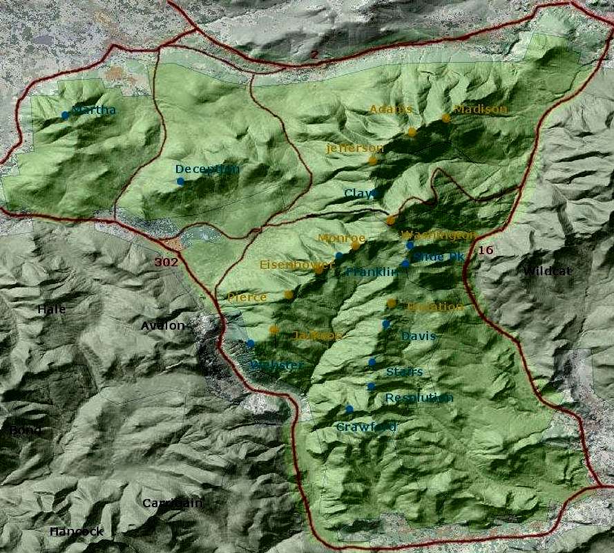
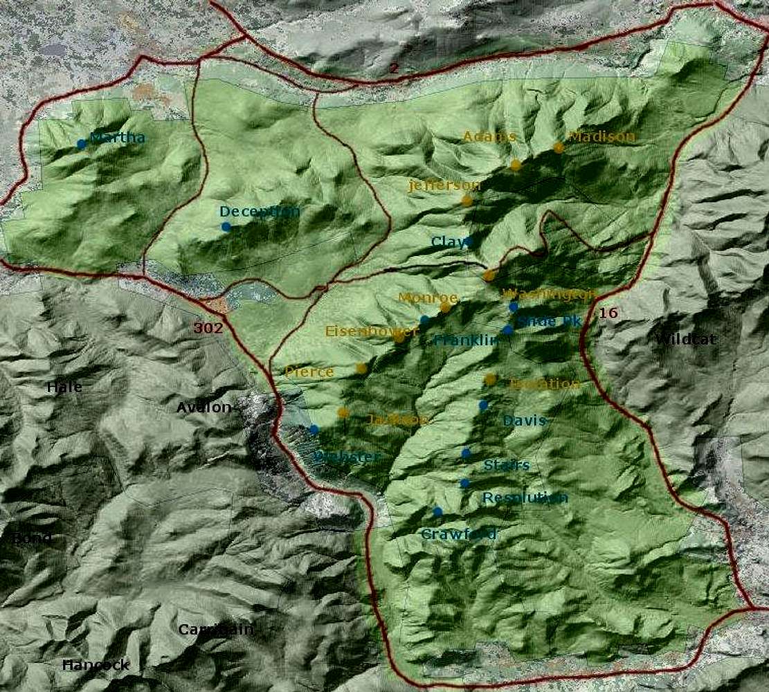
map of Presidential Range
View High-Resolution Image
map of Presidential Range
Detailed elevation map of Presidential Range. For improved interactive map. Based on public domain elevation image from geodata.gov
« PREV
NEXT »
nartreb
on
Feb 19, 2006 1:34 am
Comments & voting
Other parents
Lat/Lon:
44.28454°N / 71.30127°W
Image ID:
173781
17203 Hits
71.06
% Score
1
Votes
Log in to vote
Comments
No comments posted yet.
to post!
Don't have an account?
Presidential Range
(Area/Range)
You are at
the First
Image
Viewing
#1 of 1
GALLERY
You are at
the Last
Image
nartreb's Image Gallery
« PREV
Viewing
#685 of 815
GALLERY
NEXT »
Presidential Range
(Area/Range)
Loading....
Glossary: summit, peak, etc
(Article)
Loading....
×
You need to login in order to vote!
User Name
Password
Remember me
Forgot your password?
Log me out when I close my browser.
Keep me logged in all the time.
sign in as a user
Don't have an account?
Register now for FREE
Rating available
Suggested routes for you
People who climb the same things as you
Comments Available
Create Albums
Register Here


