Toggle navigation
Mountains
Routes
Images
Trip Reports
Forum
What's New
People
Areas & Ranges
Articles
Trailheads
Canyons
Huts & Campgrounds
Albums
Logistical Centers
Fact Sheets
Lists
Custom Objects
Gear
Plans & Partners
WELCOME TO SUMMITPOST
SIGN IN
REGISTER
“Keyhole Plateau” (0.8 mi NW of Mt. Lamarck)
Additional Parents
Photo of the Hour
Image
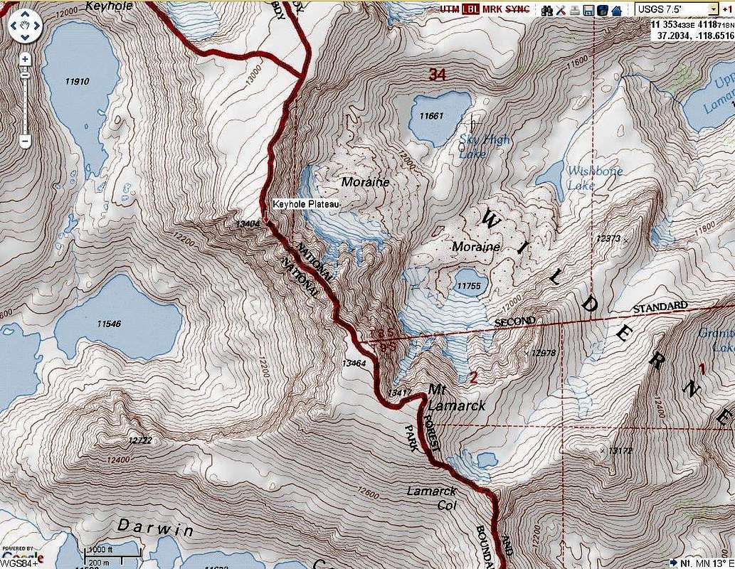
Keyhole Plateau topo map
View High-Resolution Image
Keyhole Plateau topo map
Made from CalTopo.com for Sierra Challenge 2012:
http://caltopo.com/map?id=1O28
(Print from Caltopo for higher resolution)
« PREV
NEXT »
relsdon
on
Jan 27, 2012 10:16 pm
Comments & voting
Other parents
Lat/Lon:
37.20340°N / 118.6803°W
Image Type(s):
Topo/Diagram
Image ID:
773563
4156 Hits
0
% Score
0
Votes
Log in to vote
Comments
No comments posted yet.
to post!
Don't have an account?
“Keyhole Plateau” (0.8 mi NW of Mt. Lamarck)
(Mountain/Rock)
« PREV
Viewing
#9 of 9
GALLERY
You are at
the Last
Image
relsdon's Image Gallery
« PREV
Viewing
#4 of 5
GALLERY
NEXT »
Photo of the Hour
(Album)
Loading....
×
You need to login in order to vote!
User Name
Password
Remember me
Forgot your password?
Log me out when I close my browser.
Keep me logged in all the time.
sign in as a user
Don't have an account?
Register now for FREE
Rating available
Suggested routes for you
People who climb the same things as you
Comments Available
Create Albums
Register Here


