
Viewing: 1-4 of 4
knip - Dec 26, 2012 9:49 pm - Hasn't voted
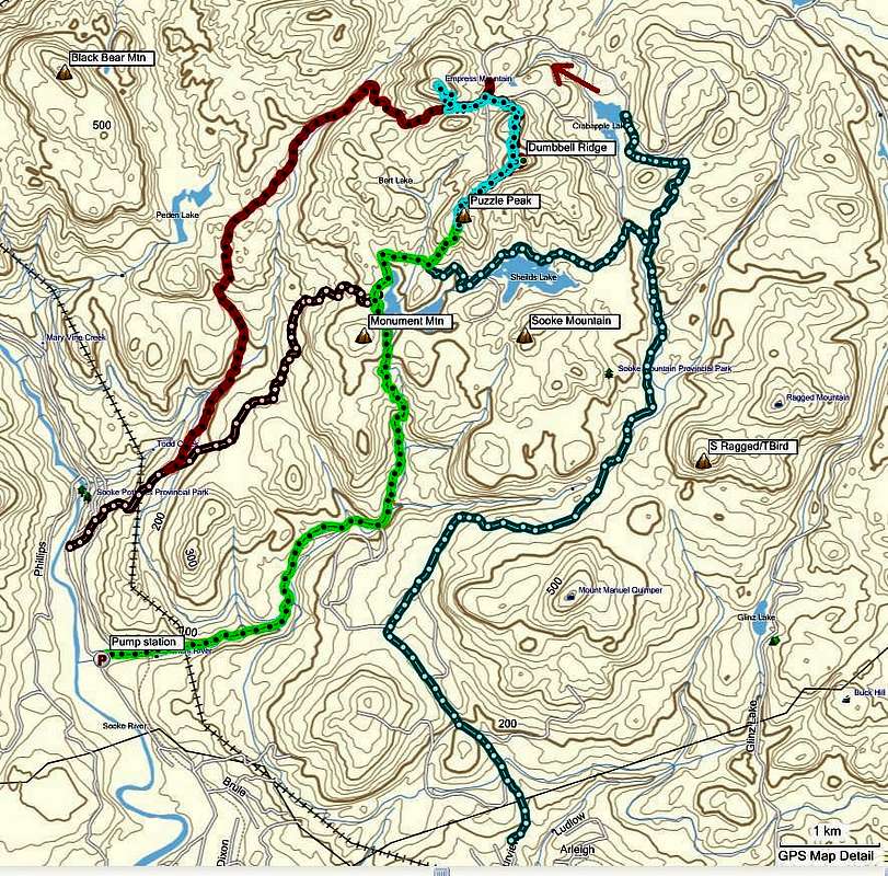
GPS tracksWhat are the chances of getting GPS tracks for this image? knip_me@yahoo.ca
Many thanks.

vancouver islander - Dec 27, 2012 4:24 pm - Hasn't voted
Sent via emailHave fun !!!
cameronsgray - Jun 28, 2015 1:36 pm - Hasn't voted
GPS TracksHi Vancouver Islander and Knip I would really appreciate the GPS Tracks as well (.GPX preferred) if you are able to share them.
Thanks so much!
cameron.s.gray@gmail.com
vancouver islander - Jul 7, 2015 10:52 pm - Hasn't voted
Re: GPS TracksSent by email July 07. Sorry for the delay.
Viewing: 1-4 of 4


Comments
Post a Comment