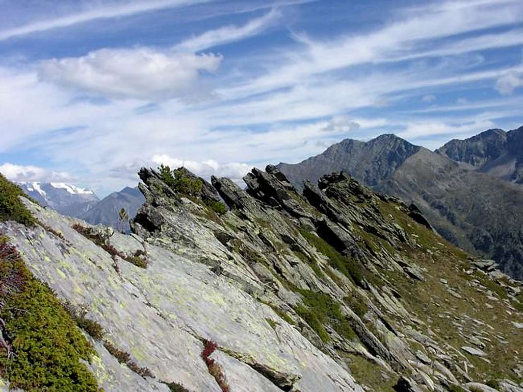
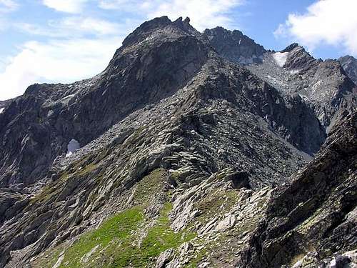
Thuilette Crest, that includes Mont Thuilette (2.420m), rises directly above the Village of La Joux (1.605m), which is part of the small Town of La Thuile (1.441m). It is the ridge, rocky in its upper part and grassy below, which comes down from Monte Freduaz Orientale (2.938m) and divides the Ponteilles Valley from Comba di Sozin. The ridge is about 1.5 km long; its elevation ranges between 2.090m and 2.560m. Throughout its ascent, one enjoys good views of the Mont Blanc Massif and of the small group formed by Bella Valletta (2.811m), Mont Valaisan (2.891m), Mont Freduaz (2.938m) with the small glaciers at its foot.
First Ascents
Unknown.
Getting There
BY CAR:
From Torino, Milano, etc: Motorway A5. Exit at Morgex.
From Switzerland: through the Grand Saint Bernard Tunnel or the namesake Pass.
From France: through the Mont Blanc Tunnel or Petit Saint Bernard Pass: It is not necessary to take Motorway A5: you can drive on SS.26, in the direction of Aosta.
BY PLANE:
Aeroporto "Corrado Gex" Saint Christophe (Aosta).
From the Morgex exit of Motorway A5 (921m), continue for about 3 km on SS.26 towards Pré Saint Didier (1.017m) SS.26 becomes the main street of the small city and then continues toward Colle del Piccolo San Bernardo (2.188m). After several hairpins, and past the Villages of Elevaz (1.302m) and la Balme (1.309m) reach the famous ski resort of La Thuile (1.441m). Turn left on the bridge that crosses the Dora di La Thuile Torrent in the direction of the Village of La Joux. After about 2 km from the bridge, having past a large square, cross another bridge on the Dora to the right. (From this point on, the road, altough paved, is quite narrow. Proceed with caution.) After 1 km get to La Joux (1.607m) and park in one of the two parking lots, which are large but sometimes fill up in August. For this reason, access past the second bridge is limited at certain times. Be there before 9 AM to avoid problems, or take the shuttle bus to cover the last stretch.
Route
After parking your car in the square, go back about 150m. Take the well-marked trail number 7, which in 30 to 40 minutes leads to Alpeggio di Maisonnettes (1.889m). Cross the stream and follow a faint trail to the pleasant Lakes of Comba di Sozin (2.170m). Once past the lakes take a sharp turn to the right and proceed until you cross trail number 18, which comes from Alpeggio di Ponteilles (2.061m). From here, climb the ridge, at first among bushes and rhododendrons (beware of vipers), then among mid- and large-sized boulders that can be easily skirted on the south. After about 100m regain the crest of the ridge and aim for Monte Thuilette, which sits just in the middle of its namesake ridge. You will encounter a few steps of I-. Past the summit, continue on the ridge, which becomes more airy and entertaining (a few moves of II). You will eventually reach the saddle under Point 2.560m(3h'00/3h'30). From here, descent toward Comba di Sozin; reach the small lakes there and reconnect to the ascent route. The route is rated E (hikers) except for the last part (PD, a little difficult).
Equipment
Standard hiking equipment, plus a short rope (10m) for safety.
Campings
Remember that free camping is forbidden (except for emergency reasons, over 2.500m, from darkness until dawn).
Mountain Condition
You can get meteo information at the official site of the Regione Valle d'Aosta:
Parents refers to a larger category under which an object falls. For example, theAconcagua mountain page has the 'Aconcagua Group' and the 'Seven Summits' asparents and is a parent itself to many routes, photos, and Trip Reports.

 5261 Hits
 89.01% Score
 28 Votes