Toggle navigation
Mountains
Routes
Images
Trip Reports
Forum
What's New
People
Areas & Ranges
Articles
Trailheads
Canyons
Huts & Campgrounds
Albums
Logistical Centers
Fact Sheets
Lists
Custom Objects
Gear
Plans & Partners
WELCOME TO SUMMITPOST
SIGN IN
REGISTER
Vasquez Peak
Additional Parents
Image
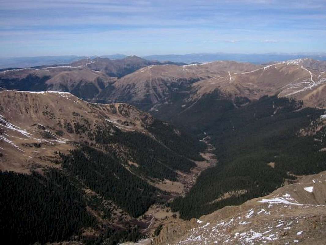
Bobtail Creek drainage and...
View High-Resolution Image
Bobtail Creek drainage and...
Bobtail Creek drainage and the Vasquez Mountains from Pettingell Peak. Byers Peak and Bills Peak are the prominent summits on the left St. Luis Peak is the summit on the right. October 2002. Jon Bradford
« PREV
NEXT »
JonBradford
on
Feb 10, 2004 11:55 pm
Comments & voting
Other parents
Lat/Lon:
39.79600°N / 105.854°W
Image ID:
41495
2301 Hits
74.92
% Score
5
Votes
Log in to vote
Comments
No comments posted yet.
to post!
Don't have an account?
Vasquez Peak
(Mountain/Rock)
« PREV
Viewing
#21 of 53
GALLERY
NEXT »
JonBradford's Image Gallery
« PREV
Viewing
#607 of 1444
GALLERY
NEXT »
×
You need to login in order to vote!
User Name
Password
Remember me
Forgot your password?
Log me out when I close my browser.
Keep me logged in all the time.
sign in as a user
Don't have an account?
Register now for FREE
Rating available
Suggested routes for you
People who climb the same things as you
Comments Available
Create Albums
Register Here


