Toggle navigation
Mountains
Routes
Images
Trip Reports
Forum
What's New
People
Areas & Ranges
Articles
Trailheads
Canyons
Huts & Campgrounds
Albums
Logistical Centers
Fact Sheets
Lists
Custom Objects
Gear
Plans & Partners
WELCOME TO SUMMITPOST
SIGN IN
REGISTER
Gray Wolf Mountain
Additional Parents
Image
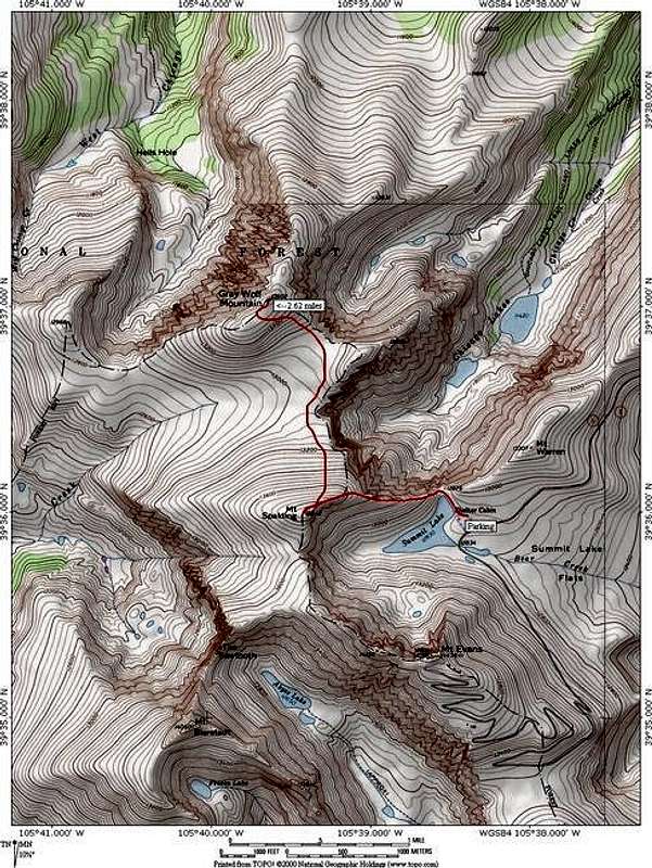
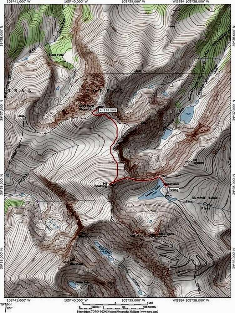
A topo of the Mount Spalding...
View High-Resolution Image
A topo of the Mount Spalding...
A topo of the
Mount Spalding Traverse Route
on
Gray Wolf Mountain
. The route is 5.25 miles round trip and only 1,500 feet elevation gain yet it nets you two summits. Software by National Geographic.
« PREV
NEXT »
JonBradford
on
Dec 23, 2004 3:54 pm
Comments & voting
Other parents
Lat/Lon:
39.61700°N / 105.66°W
Image ID:
82500
5400 Hits
74.01
% Score
4
Votes
Log in to vote
Comments
No comments posted yet.
to post!
Don't have an account?
Gray Wolf Mountain
(Mountain/Rock)
« PREV
Viewing
#34 of 45
GALLERY
NEXT »
JonBradford's Image Gallery
« PREV
Viewing
#872 of 1444
GALLERY
NEXT »
×
You need to login in order to vote!
User Name
Password
Remember me
Forgot your password?
Log me out when I close my browser.
Keep me logged in all the time.
sign in as a user
Don't have an account?
Register now for FREE
Rating available
Suggested routes for you
People who climb the same things as you
Comments Available
Create Albums
Register Here


