Toggle navigation
Mountains
Routes
Images
Trip Reports
Forum
What's New
People
Areas & Ranges
Articles
Trailheads
Canyons
Huts & Campgrounds
Albums
Logistical Centers
Fact Sheets
Lists
Custom Objects
Gear
Plans & Partners
WELCOME TO SUMMITPOST
SIGN IN
REGISTER
The Brothers (ME)
Additional Parents
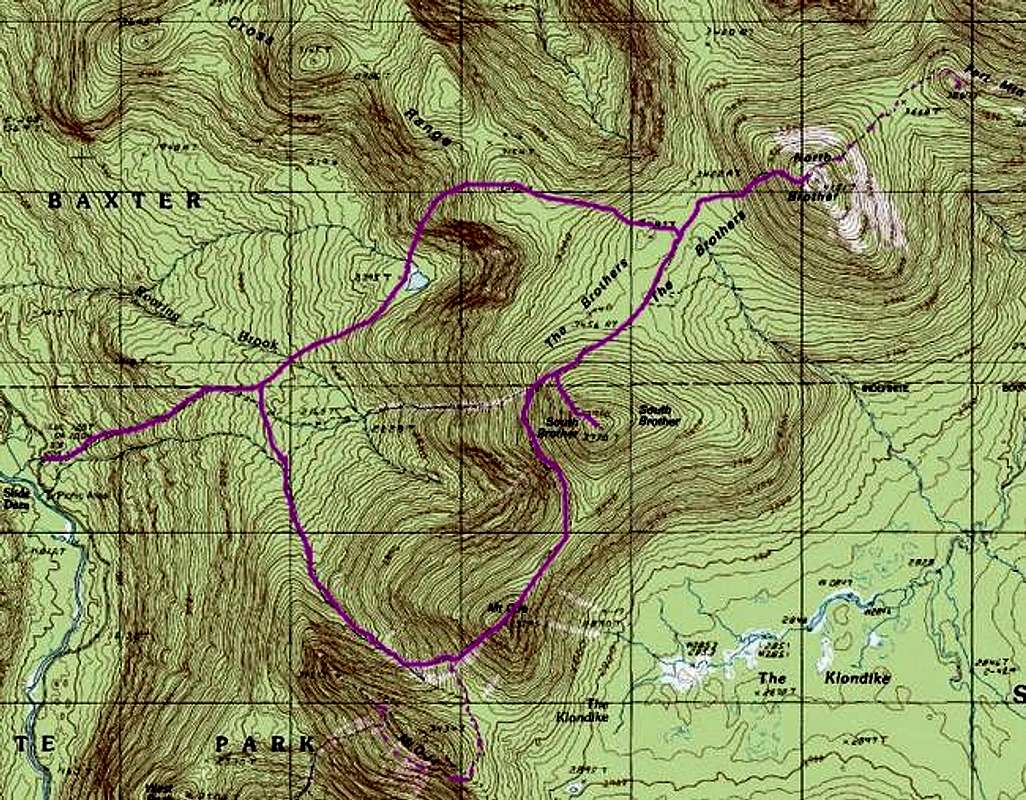
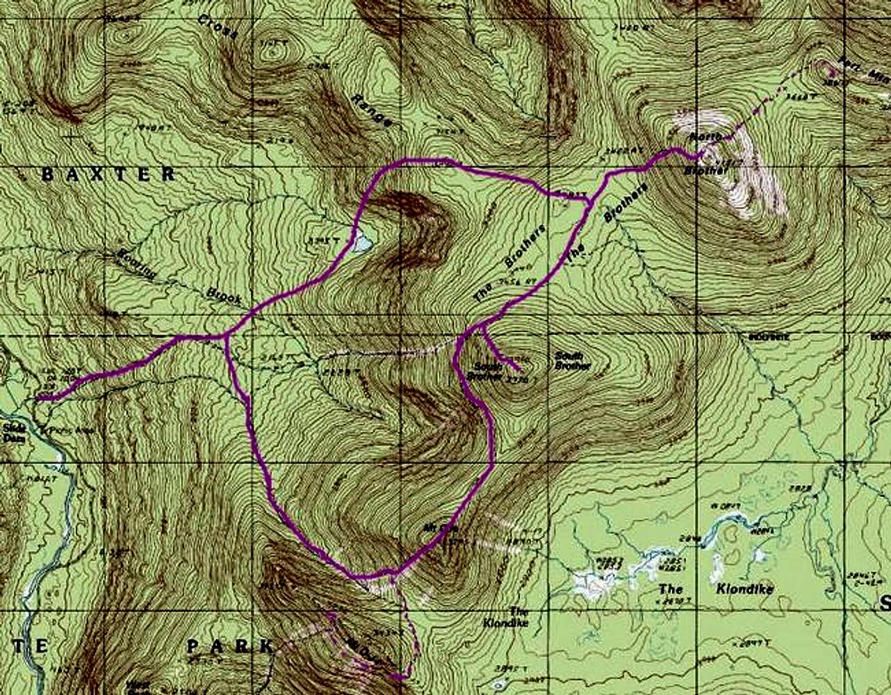
Marston Trail - Mt Coe Trail Loop
Image
Trail map as best as I can...
View High-Resolution Image
Trail map as best as I can...
Trail map as best as I can reconstruct it from out-of-date USGS map. The dotted segment from North Brother to Fort Mountain is a bushwhack even though traces of the old trail remain. Source map from Terraserver.
« PREV
NEXT »
nartreb
on
Apr 26, 2005 8:26 pm
Comments & voting
Other parents
Lat/Lon:
45.95110°N / 68.9954°W
Image ID:
102529
5533 Hits
73.06
% Score
3
Votes
Log in to vote
Comments
No comments posted yet.
to post!
Don't have an account?
The Brothers (ME)
(Mountain/Rock)
« PREV
Viewing
#19 of 25
GALLERY
NEXT »
nartreb's Image Gallery
« PREV
Viewing
#408 of 815
GALLERY
NEXT »
Marston Trail - Mt Coe Trail Loop
(Route)
Loading....
×
You need to login in order to vote!
User Name
Password
Remember me
Forgot your password?
Log me out when I close my browser.
Keep me logged in all the time.
sign in as a user
Don't have an account?
Register now for FREE
Rating available
Suggested routes for you
People who climb the same things as you
Comments Available
Create Albums
Register Here


