
-
 28895 Hits
-
 84.82% Score
-
 19 Votes
|
|
Mountain/Rock |
|---|---|
|
|
38.12510°N / 105.6436°W |
|
|
13423 ft / 4091 m |
|
|
Overview
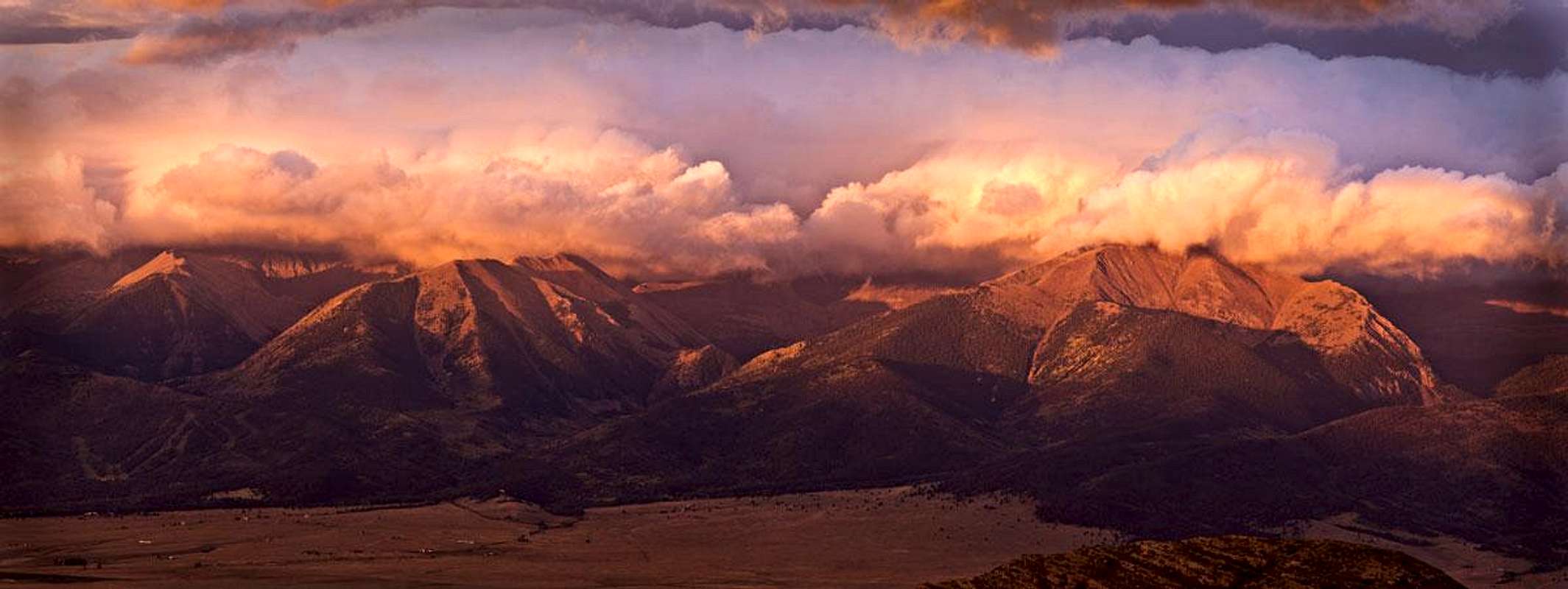
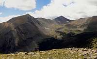
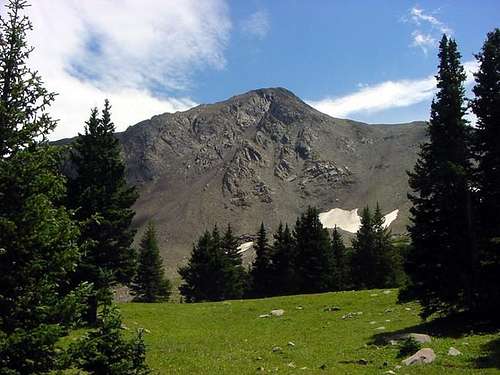
Spread Eagle Peak is ranked the 306th highest peak in Colorado and towers over the beautiful Lakes of the Clouds basin. The peak dominates the western skyline while approaching the Gibson Creek trailhead from Westcliffe. It's close proximity to the Wet Mountain Valley makes it a nice dayhike with less crowds or a great winter climb.The summit contains a CMC summit register showing that the summit sees a few folks on summer weekends with light mid-week traffic.
The easiest route on Spread Eagle Peak from the Lakes of the Clouds is steep Class 2 with a faint climbers trail for part of the way up to the saddle. From the saddle up to the south ridge never exceeds steep Class 2 but there is some exposure for the last 200 vertical feet of scrambling. Another route heads up Gibson Creek
  |
Getting There

Spread Eagle Peak

Spread Eagle NE Face

Spread Eagle NW Face

Spread Eagle Peak
Spread Eagle from the North

Point 13,524
From the center of Westcliffe, Colorado head south on Colorado Highway 69 for a short distance. Just as you are leaving town take a right turn on the well signed Hermit Road.
Continue west on Hermit Road for almost six miles. About halfway through the six miles the road will come to an intersection where the pavement heading west ends. Continue west (straight) on the now gravel Hermit Road. Spread Eagle Peak is now towering ahead of you.
At about six miles from Colorado Highway 69 you will come to a fork in the road. The left fork heads up the four wheel drive road to Hermit Lake and ultimately to Hermit Pass. Take the right fork which is the cut-off to C.R. 172 North Taylor Road. Take a left on North Taylor Road towards some private residences. You will soon see a sign for the Gibson Creek Trailhead and pass through the forest service gate.
Once through the forest service gate you will see parking for horse trailers and group camping. This last 0.2 miles from the gate to the signed trailhead is pretty rough but is passable to most high clearance vehicles. Four wheel drive would most likely be necessary in wet or snowy conditions.
 |
Route Options
Lakes of the Clouds Trail/South Ridge
Class 2 - 13 miles RT and 4,400 feet
This is the standard route on Spread Eagle Peak and starts from the Gibson Creek Trailhead. Head north from the trailhead on a connector trail which leads to the Rainbow Trail. Turn right (north) on the Rainbow Trail. After about a half mile you will come to a signed trail junction. Take a left on the Swift Creek Trail towards the Lakes of the Clouds. You will soon come to the Wilderness Boundary and the Forest Service sign-in book. After a little over 3 miles from the trailhead you will come to another trail junction. Take a left towards the Lakes of the Clouds (right heads back down to the Rainbow Trail). The trail steepens with occasional switchbacks as it heads up into the basin containing the lakes. The lower lake is about 4 miles from the trailhead, the middle lake is about 4.25 miles from the trailhead and the upper lake is about 4.5 miles from the trailhead. There are several excellent backcountry campsites around the upper lake. There is also good fishing at the upper lake. This trail is described in detail in Falcon Guide's "Colorado's Sangre de Cristo Wilderness" book and is shown on the Trails Illustrated Map #138, "Sangre de Cristo Mountains.
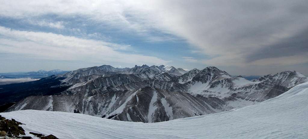
From the upper lake, pick your way up grassy slopes well to the left of the small waterfall visible from near the upper lake, avoiding rock outcroppings and ledges towards the saddle south of Spread Eagle Peak. The only tricky part in this area is finding a good place to cross the creek which is well lined with vegetation. You may occasionally find a faint climbers trail that will ease some of your scramble to the saddle. Once at the saddle at just over 13,000' head left up the south ridge. There is a small 13,165 foot nub in the way you will have to hike over. The ridge narrows to less than 10 feet with exposure on both sides. At a point where the ridge becomes a technical climb the loose trail (more of a worn out section of tundra) veers right below the ridge to the east. From here the trail climbs the last few hundred feet through a mix of grassy slopes and boulders with great exposure to the right. From the summit the Crestones can be seen to the south and all the surrounding peaks just beg to be climbed!
Spread Eagle Peak South Ridge
 Spread Eagle from lower lake Spread Eagle from lower lake |  Hiking to the saddle Hiking to the saddle |  Hiking up the South Ridge Hiking up the South Ridge |  Looking down the South Ridge Looking down the South Ridge |
 The Wet Mountain valley The Wet Mountain valley |  Looking south from east ridge Looking south from east ridge |  Spread Eagle summit Spread Eagle summit | 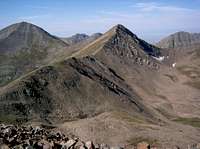 Rito Alto from Spread Eagle Rito Alto from Spread Eagle |
Map
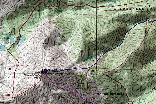
RED: Lake of the Clouds and South Ridge - Class 2
BLUE: Gibson Creek and East Ridge - Class 2
PURPLE: Southeast face ski route - Class 2 and Steep snow
Camping/Gear
 Spread Eagle Peak from the tent
External Links
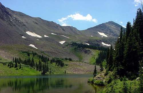
 Nearby Rito Alto Peak