
-
 18369 Hits
-
 74.92% Score
-
 5 Votes
|
|
Mountain/Rock |
|---|---|
|
|
37.80000°N / 46.40000°E |
|
|
iran |
|
|
Mountaineering |
|
|
Spring, Summer, Winter |
|
|
12162 ft / 3707 m |
|
|
Overview
Sahand is an eroded stratovolcanic massif in northwestern Iran, about 25 miles (40 km) south of the major city of Tabriz. The most recent dated lavas are about a million years old, so the volcano is most likely extinct. The area does receive substantial winter snowfall at higher elevations. Iran map
Getting There
Access should be relatively easy from the main highway east of Tabriz which passes to the north, or from the city of Maragheh located just to the south.Red Tape
There is no Red Tape .Camping
Camping is allowed every where. There is a hut in the area .External Links
climbing.irOaj Mountain Climbing Club
Maps
Topographic map of Sahand (1:253,440 scale) from British WW2-era Military Map J38-Q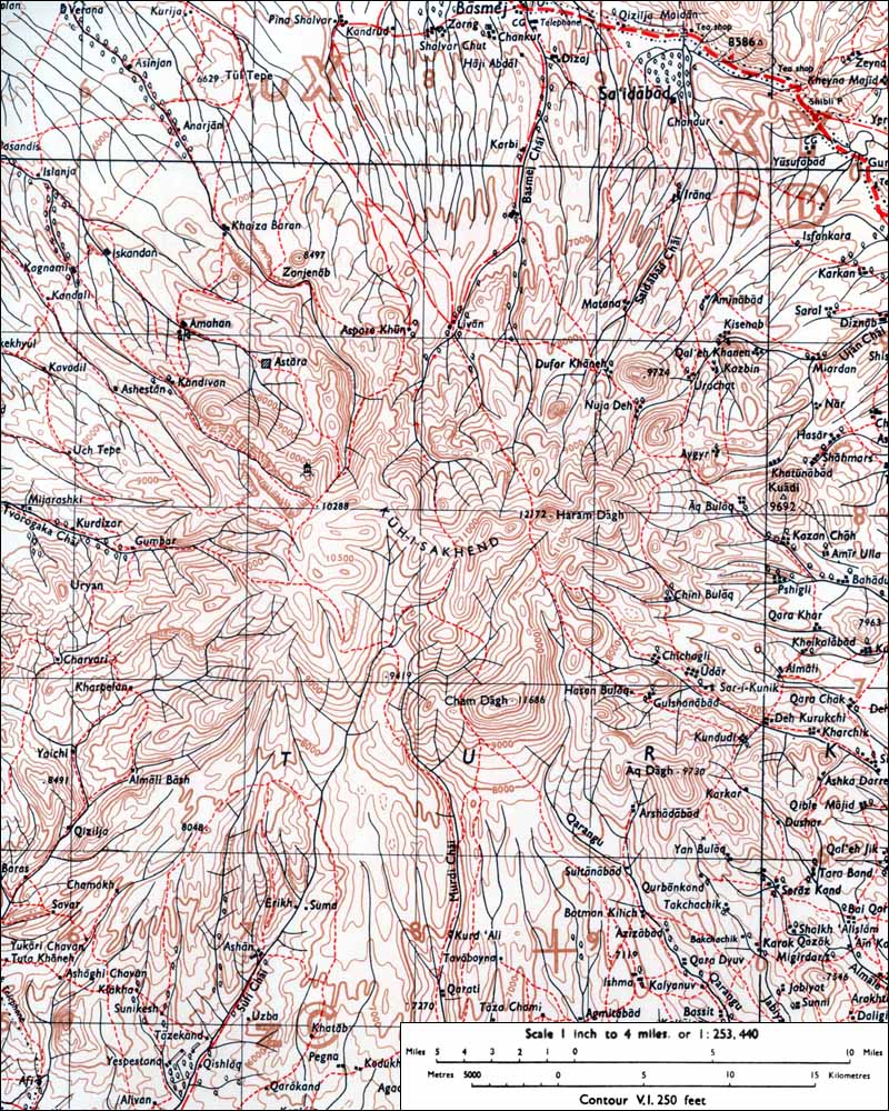
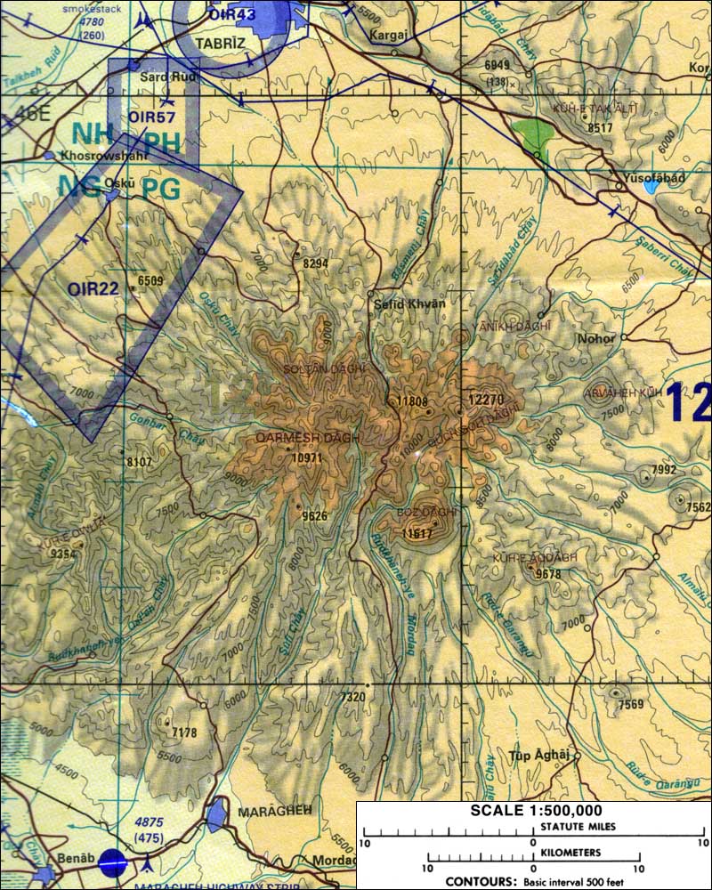
Topographic map of Sahand (1:500,000 scale) from Tactical Pilotage Chart G-5A