


imontop - Nov 22, 2008 11:33 pm - Voted 10/10
Where?Is this taken from the East Fork of the Blacks Fork?

Dmitry Pruss - Nov 23, 2008 10:13 am - Hasn't voted
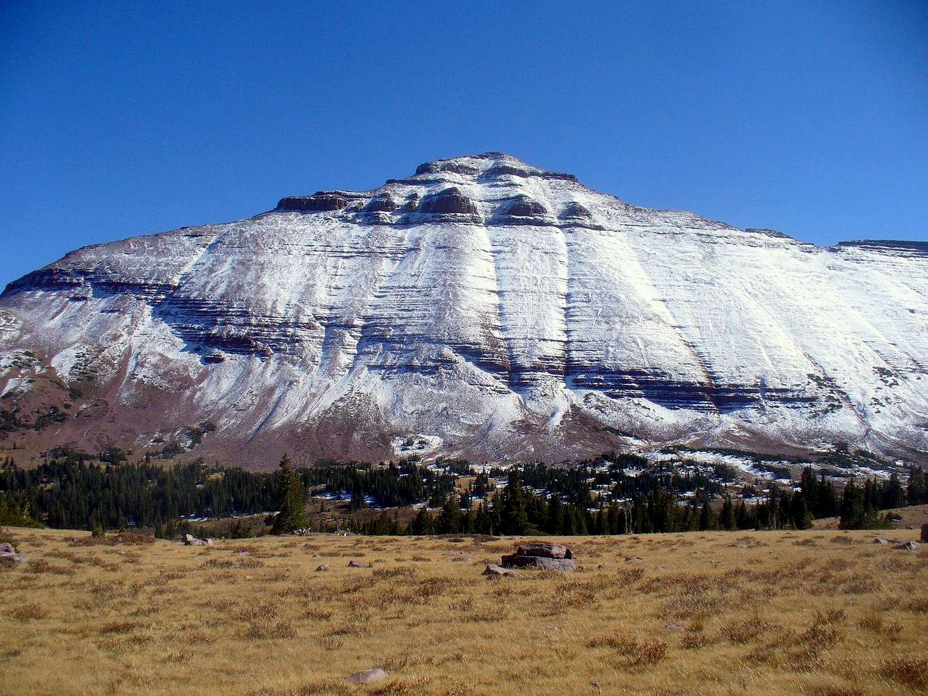
Upper Basin of East Forkyes, that's the valley to the NW of the peak.
imontop - Nov 24, 2008 6:40 pm - Voted 10/10
Re: Upper Basin of East ForkOk, I know where you're at now. Very nice page by the way.

yatsek - Dec 23, 2008 4:31 pm - Voted 10/10
Great BackgroundSeems like I've already taken to your Lovenias since they make me think hard:). So surely the background looks great but I also like the foreground as there's the grasses: alpine tundra or steppes? Or both? A matter of definition maybe, as usual.
Dmitry Pruss - Dec 23, 2008 4:43 pm - Hasn't voted
Not a steppeAlpine meadows and alpine tundra are a continuum of sorts, both are above the timberline, classic meadows have taller grasses and classic tundras have low shrubs, but the transition may be smooth! I would call this picture's foreground meadows, because the plants are taller and the shrubs are virtually absent. Timberline is at about 11,000 ft in the Uintas.
Steppe, or prairie as this habitat is better known in the West, is generally below 7-8,000 ft in the Uintas. Still there are many forested areas in the foothill prairie, especially along the creeks.
All of these areas recieve too much precipitation to be a true desert, but our popular tradition still names the driest, lowest-elevation parts of Utah "deserts". Annual precipitation there is 150-200 mm, so it is scientifically a semi-desert at best.
yatsek - Dec 23, 2008 5:24 pm - Voted 10/10
Re: Not a steppeI guess true desert can only be inside a (wo)man's heart. As for terms and categorizing, it looks like we're going too academic. If the amount of precipitation is the criterion, then tundra is actually semi-desert:)(I personally prefer the more ecological/plant science stand.) Anyway, I found the timberline at 3,300m sort of shocking high, probably partly because what we call timberline here (I suppose it might be a Russian:) influence, or perhaps German) is a few hundred metres below the US/British timberline, that is to say the mtn pine zone here is above the timberline:). But talking of those trees at 11,000 ft, it's clear evidence it's still quite warm at this aL(slowed down:))titude. Consequently, there should be - wasn't it more like this in the Caucasus? - more ALPINE TUNDRA MEADOWS:D up above there near the mtn tops. Can so much snow and glaciers just gone have anything to do with that?
yatsek - Dec 24, 2008 6:34 am - Voted 10/10
PSDmitry Pruss - Dec 25, 2008 6:09 pm - Hasn't voted
Re: Not a steppeThere is some intuitive truth in comparing tundra to semi-desert, of course. Even though it has plenty of water, the plants have difficult time utilizing water efficiently when it is too cold. (Just like the plants of peat bogs often show signs of adaptation to dryness, such as waxy / hairy leaves, because they just can't use the cold groundwater well).
That's why the subalpine meadows of the Caucasus are so lush, because they have both water (from snowmelt runoff) and warmer temperatures. In the Uintas, summers are usually too short and too cold for the meadows to be so rich.
yatsek - Dec 26, 2008 10:26 am - Voted 10/10
Re: Not a steppeAnd, much more 'mechanically' tundra could be likened to semi-desert as the precipitation's often below 250mm. Thus:
<100mm artic/polar desert;
100-250 low tundra = "arctic semi-desert"
250-500 lusher tundra = "arctic steppe" :-)
You know I'm not a fan of such mechanical approach but it looks quite logical once we accept "arctic desert":)
Dmitry Pruss - Dec 26, 2008 3:05 pm - Hasn't voted
Re: Not a steppeHigh Uintas receive a lot more preciptation than 500 mm a year.
Mean annual precipitation (MAP) at the 16 SNOTEL sites in the Uinta Mountains ranges from 546 to 1067 mm (mean of 766 mm) and generally higher-altitude stations receive more precipitation, but they are all located below timberline. So we can reasonably expect that local alpine tundras get at least 1000 mm a year.
yatsek - Dec 26, 2008 3:46 pm - Voted 10/10
Re: Not a steppeUp to 2m? But that'll be mainly winter snow, right?
BTW I've found 2-3 pics which might fit in your Age of Canvas, though one shows an external-frame backpack as well - late '70s - might be too modern I'm afraid:)
PS Thanks for the MAP link though it doesn't work yet:))
Dmitry Pruss - Dec 26, 2008 4:08 pm - Hasn't voted
Re: Not a steppeFixed the link. No, it rains a lot in summer too. In fact at this mid-elevation station, the highest-precipitation month is August.
Where do you think Utah farmers get their water from? Uinta streams is the #1 source.
yatsek - Dec 26, 2008 4:23 pm - Voted 10/10
Re: Not a steppeThought you drank Salt Water and were all Mormons:) Thanks for the data.
yatsek - Dec 30, 2008 8:42 am - Voted 10/10
Re: Not a steppeAnd I wonder what she means by "viscious tree lines"
Dmitry Pruss - Dec 31, 2008 2:34 pm - Hasn't voted
visciousbeats me. And she isn't even the 3rd wife of a prophet, so I just wouldn't expect her to be writing in code LOL


Comments
Post a Comment