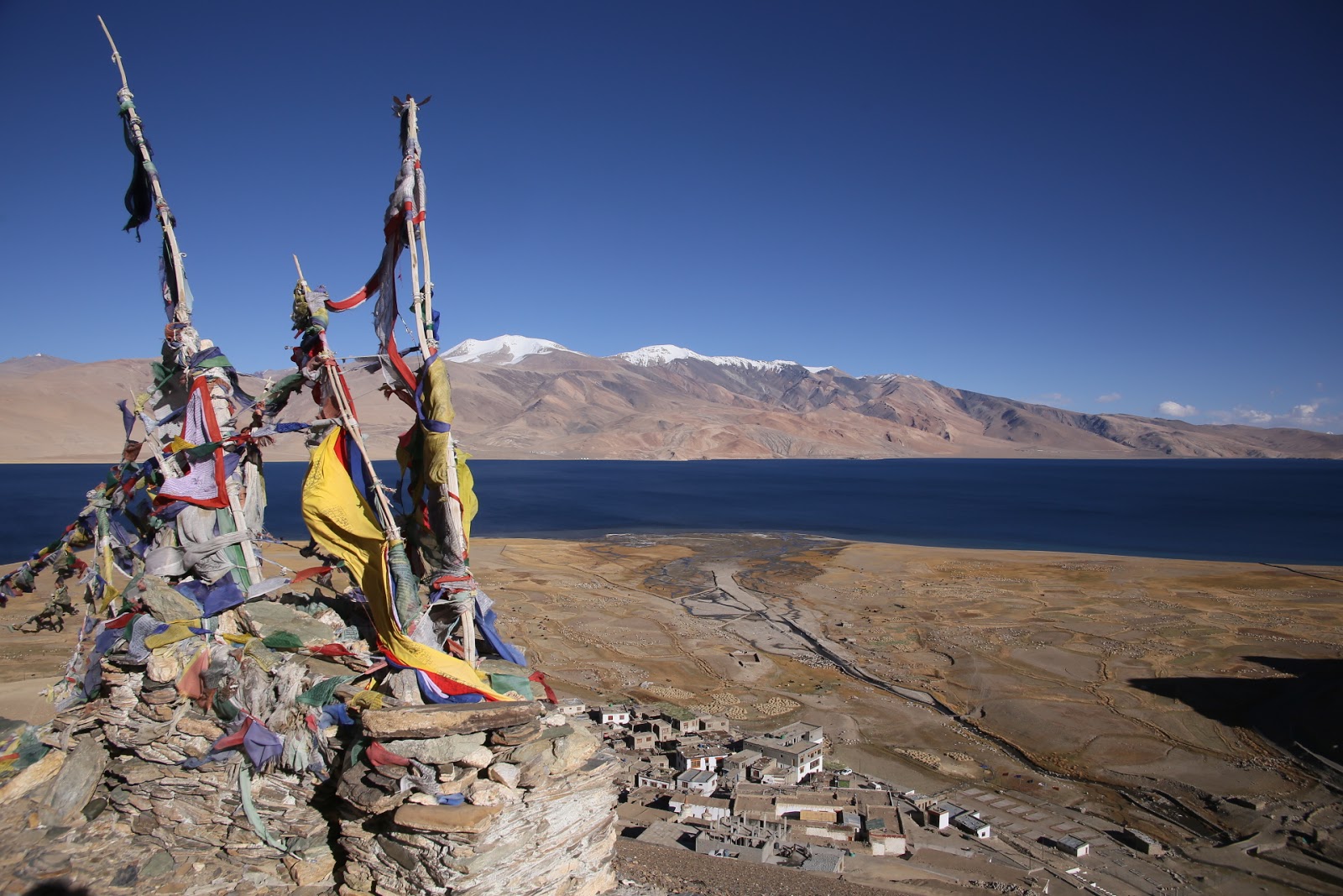
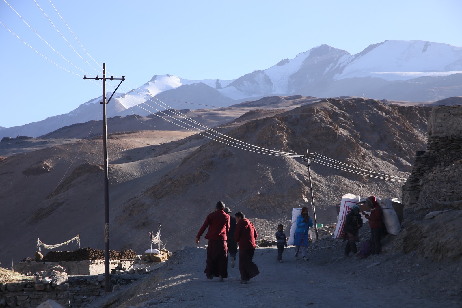
A few days were spent getting used to thenew altitude of 4500m , admiring the lakeside setting. Although Korzok is a destination for mostly Indian tourists, it was a very basic village. The guesthouse had some very fancy taps in the bathroom. But because of the frozen pipes,none of them worked! So anything including toilet flushing was done with a bucket filled from a bigger water tank out in the hallway. Little mice ran around the dining room, all over plates and cups! But the place was actually very clean and once over the initial shock of having solar power only after8pm, and no running water , it wasn’t such a bad place after all.
The mice were all through the village anyway, attracted to all the grain being harvested at the end of summer. Each day,
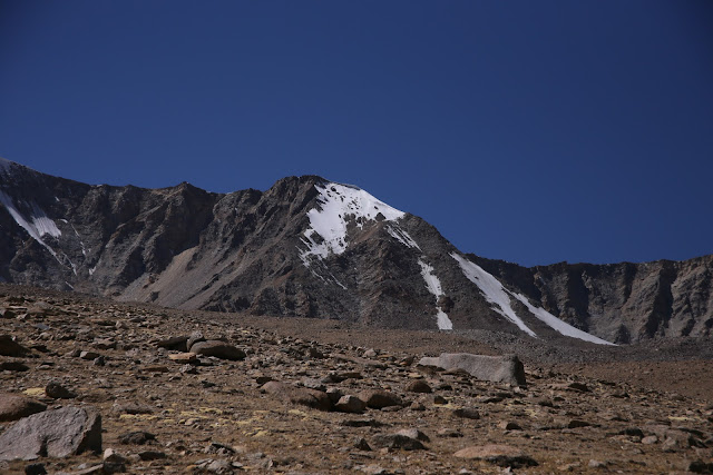
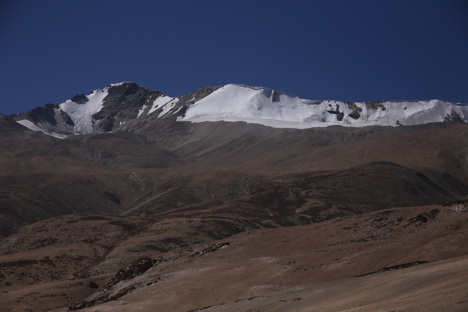
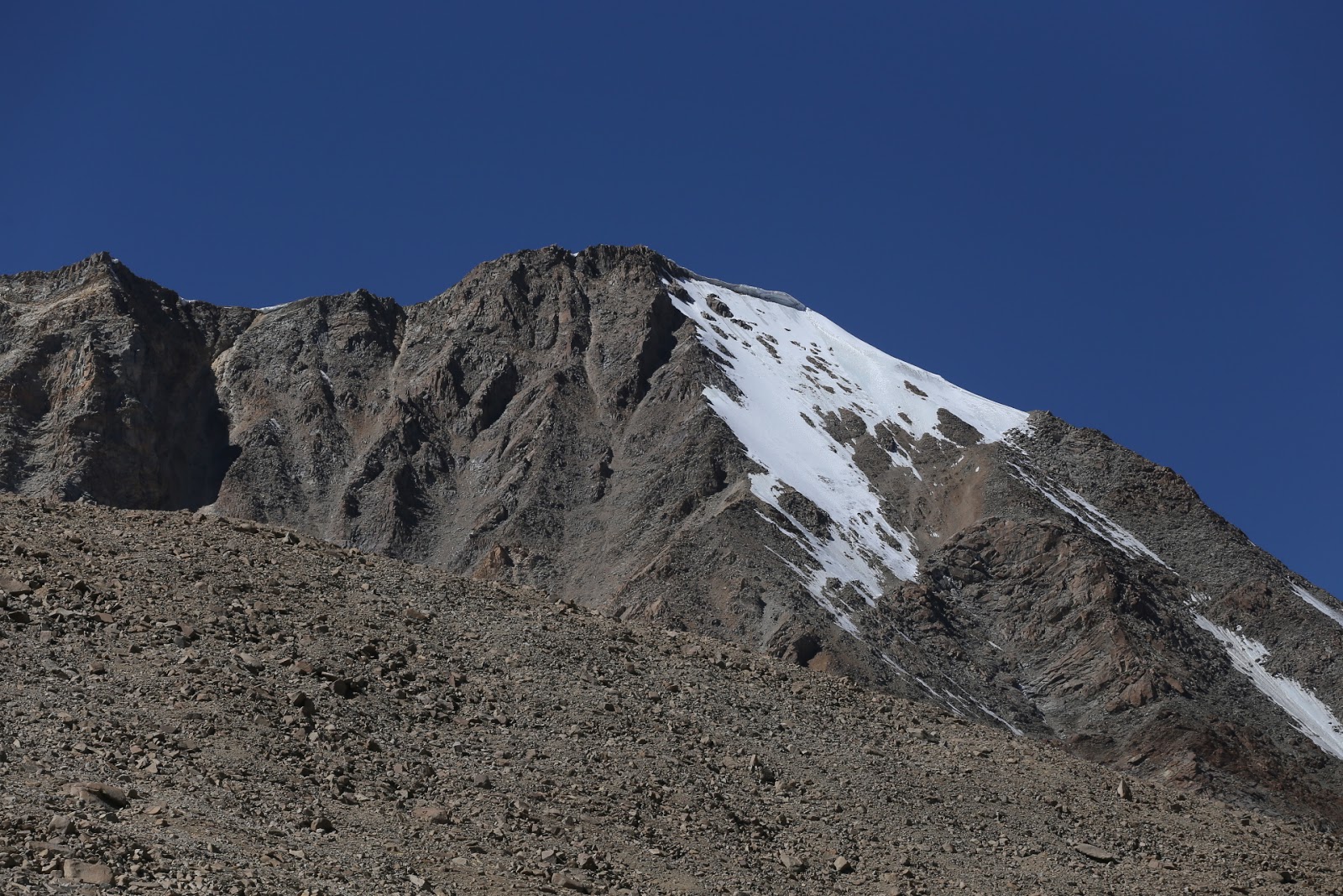
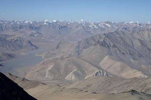
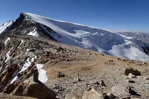
My goal was to climb one of the 6000m peaks of Mentok Kangri. The mountain range is a long escarpment called the Korzok Range, dominating the western shore of Tso Moriri. It looked very close to the lake. However,the walk to the base camp the following day proved that to be very wrong. There is nothing to give scale in the landscape. The mountains are enormous. Chamser and Lungser Kangri to the east are both 6600m highbut looked like very gentle climbs. Climbing them is now forbidden as the Indian Army have become more concerned about the Chinese border’s close proximity. Evenin recent times, some nomads were taken by Chinese Army and interrogated for days before being returned home. The innocent nomads really didn’t have any idea why they were abducted at all!
So Mentok is pretty much one of the most easterly climbs left in this area of Northern India.
 |
| Lungser and Chamser Kangri across from Tso Moriri |
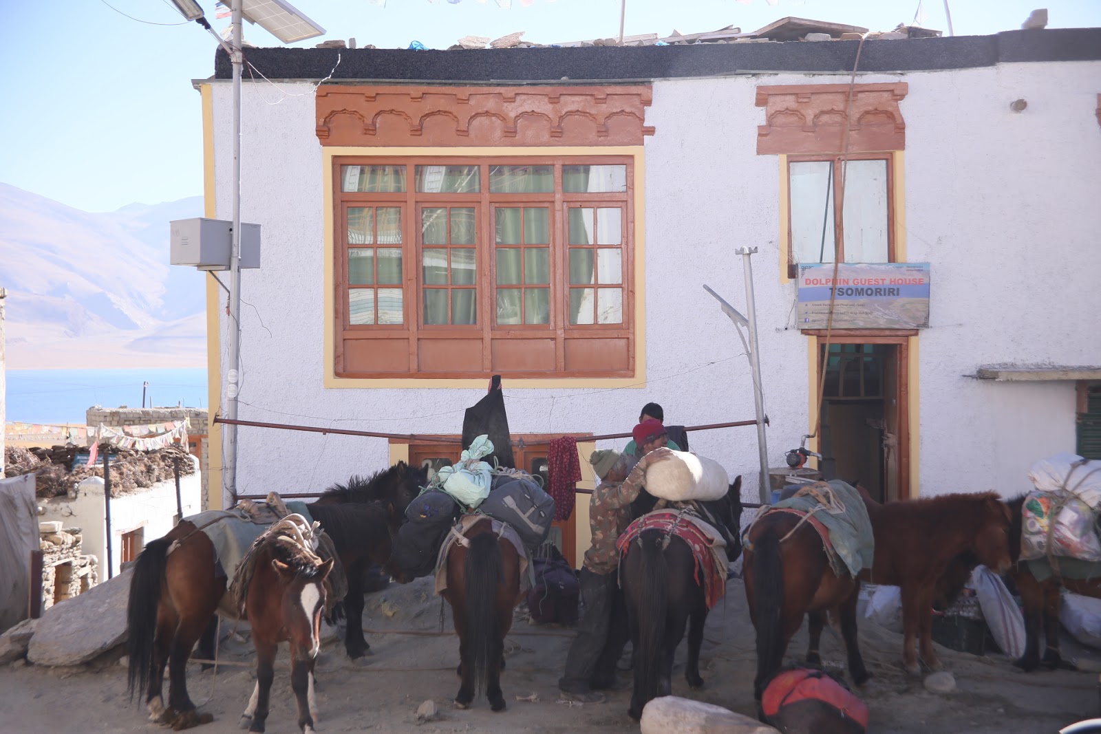
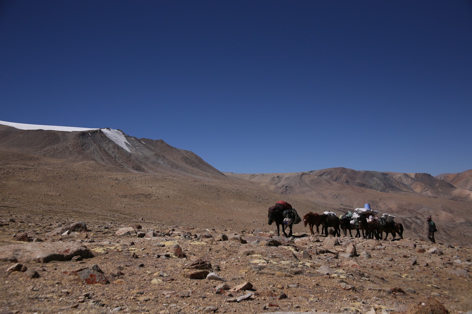
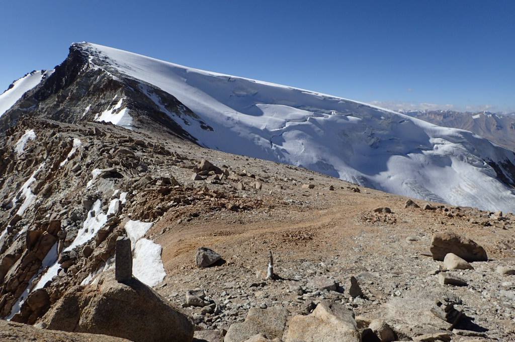
The climb to base camp was a little soul destroying. Anytime a ridge was reached, it only proved to be a false summit. The Himalayas are very good at doing this! The ponies carrying our gear for base camp didn't seem to mind the ascent...but later we were to discover our pony man had trouble with the altitude, and a day later would make a quick exit out of the camp! He then got lost and spent the night out in the cold.
 |
| Ponies approaching Mentok Base Camp |
 |
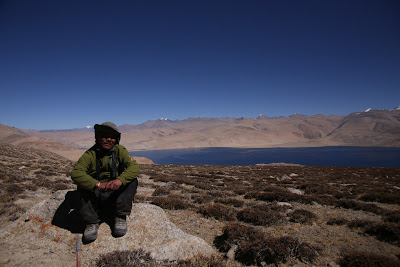
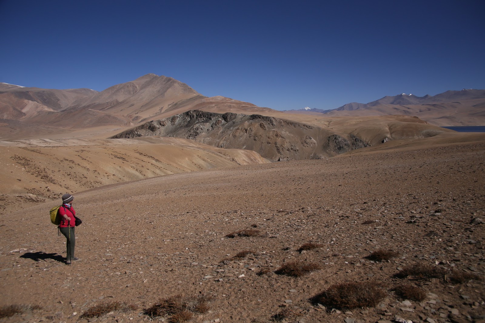
| Julie looks across the vastness of Changtang |
As BC was 5400m up, this was a big jump in altitudefor one day. Arrival at BC left us feeling pretty wasted and needing rest. Another full day gave a good chance to normalise to the new altitude, but strong cold winds kept the tent flapping around all night. The kitchen crew actually saw their large tent begin to blow away butthey managed to save it.
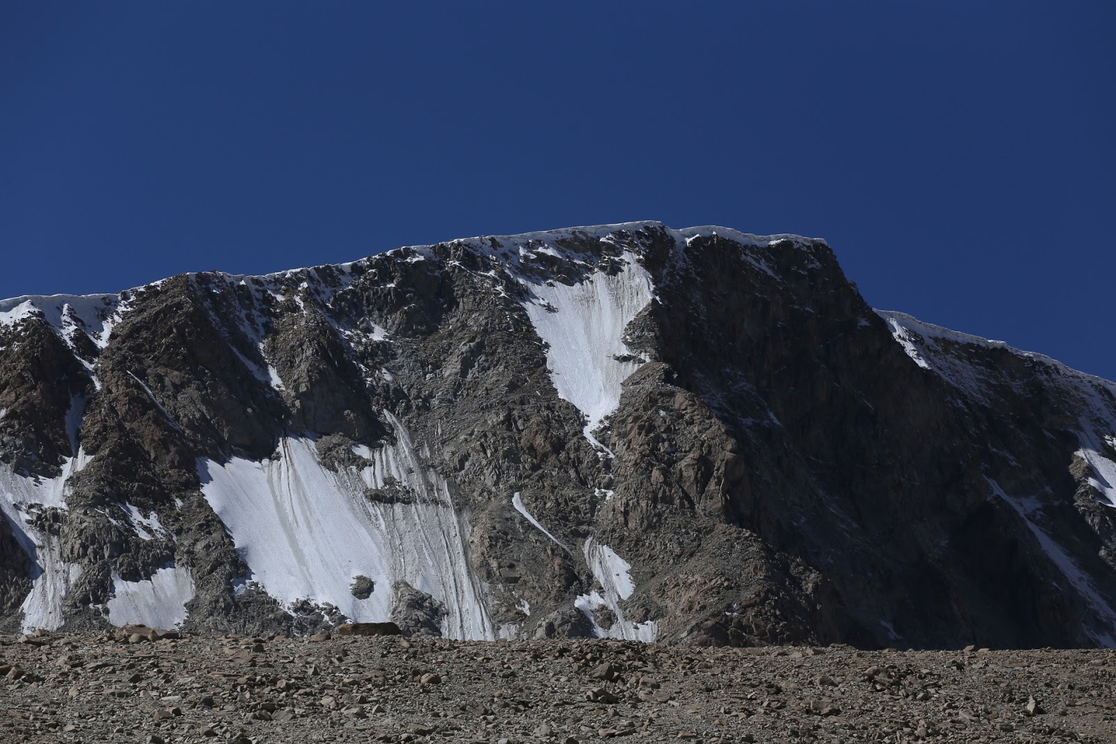
 |
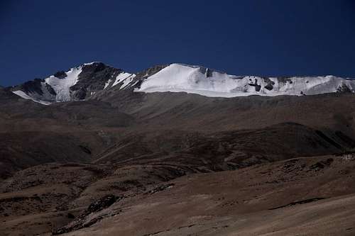
| Korzok Range |
 |
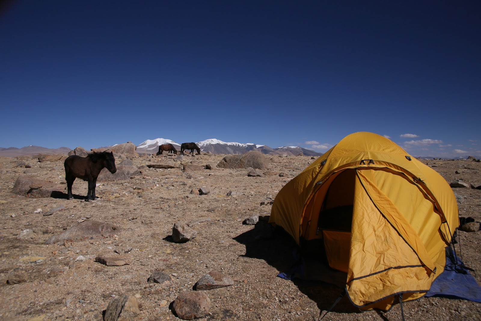
| Mentok Base Camp 5400m |
There was no water at base camp, so ice had to be chipped from the nearby glacier and brought back to camp in big sacks! It was then melted in a large pot for drinking and cooking. The tenacity of our support team was always amazing!
 |
| Namgyal taking a well earned rest |
Luckily the weather gods were feeling kind,and the storm must have been over on a distant range. Our skies were mostly clear, so we set off in the freezing cold of a dark starry morning. My drinking water bladder hose froze immediately. I estimated it was about -10C. I knew this was likely to happen, so already had backup water in a Nalgene bottle in a ”bottleparka” to stop it freezing. It did work,but developed some ice anyway…
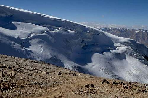
Meteors flashed across the starry sky as we tackled the loose moraine by torchlight for hours, getting closer to the glacier. Mentok reared up like a dark wall beside us. Slowly we made it to the foot of the glacier.
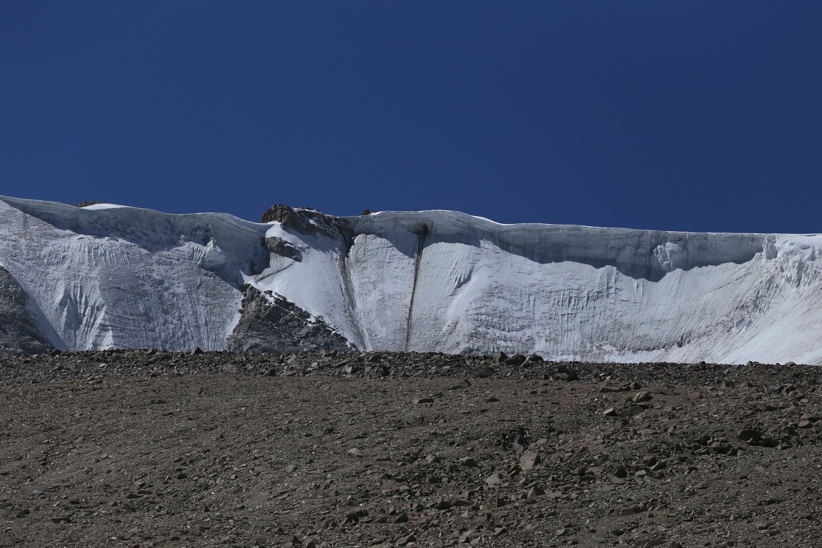
The glacier made odd twanging sounds occasionally.Just reminding me it was alive, not a static ice field…
 |
| The twanging glacier |
Then as the sun rose and warmth began toenvelope us, the climbing got steeper as we tackled the rocky ridge.
 |
| Morning sun on our mountain |
Nearly everything was unstable. You could trust nothing! Big loose granite rocks, which moved when stepped on or just came out in your hands. Add tothat the ever increasing altitude (by now it was 5800m) and things just got tougher. I recall thinking “I’m doing this again! I must be crazy”.
 |
| Happy face , happy place. I just cant breathe! |
I had two voices in my head on either side of me. One said “You don’t need to go up there, you can see the same view from here…what’s the point?”
I would take 5 more steps, telling both of my opposing forces to shut up and then just kept climbing…. Focussing on a fixed point about 5m away seemed to work, Get to that, rest, then go to another one. And so on...
At a midway point a white band of rock appeared. Namgyal had gone up a slightly different way, but the rock looked appealing, with plenty of holds. However, almost in an act of seduction, the rock got slowly steeper and harder, leading me to more complex climbing that I was getting less comfortable with.
 |
| The "White Band" |
I managed to work my way out of the conundrum and soon Namgyal andI were together again, slowly advancing towards the top of a very rocky ridge.
 |
| It gets worse before it gets better |
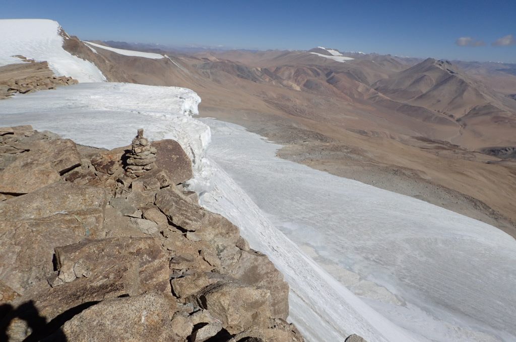
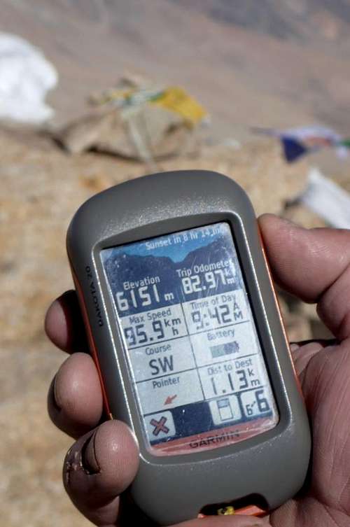
About 100m from the top now, and my GPS readthat we were over 6000m. I felt relief and took a photo of it just to prove Ihad done this 4 times now. The prayer flags at the summit were visible now, but still looked far above us.
 |
| Above 6000m and still going... |
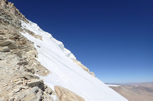
The climb steepened yet again and on one side the treacherous ice wall of 800m slid away below us. Namgyal had considered goingup it, but the ice was so smooth and glassy it would become a death slide. Not even an ice axe or crampons would gain purchase on it. The warm days and freezing nights had turned the ice into a frozen rock-hard mass. The tricky rock climb by comparison was a much better option.
 |
| View north to Spangnak Ri (6300m) |
My pace was much slower now, with the high altitude taking its toll. I felt quite fit though. Still wondering how I have done this before and why I persist doing it again!!
 |
| Almost at the prayer flags |
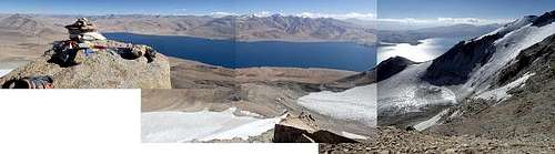
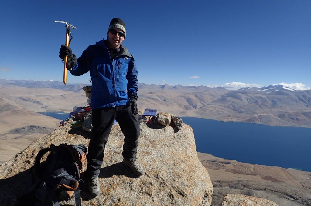
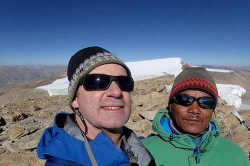
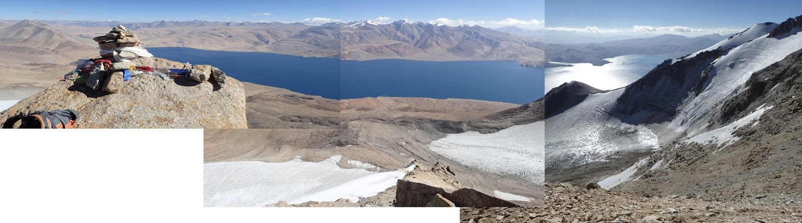
Yet less than 20 minutes later the summit cairn of Mentok 2 was reached. Namgyal and I shook hands then hugged! I was elated, especially since I had climbed over 6000m 2 other times since
summiting Island Peak, and yet had never truly stood on top of a Ladakhi mountain. The GPS read 6151m. And the feeling was pretty damn good!
 |
| Mentok 2 (or 3?) Summit cairn! 6151m |
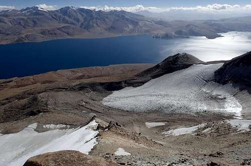
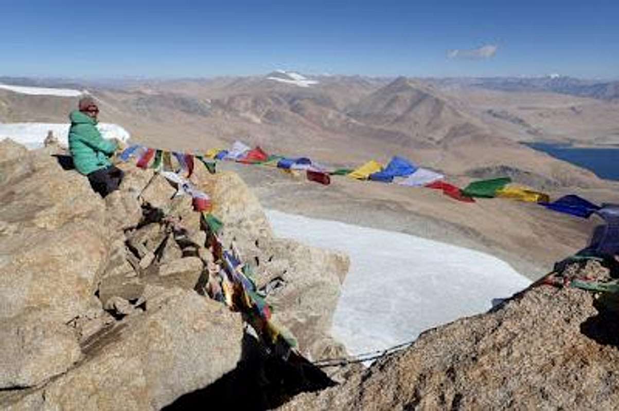
I stood on the top and admired the amazing view. Cloudless in all directions. I could see the entire Great Himalaya Range to the west, into Chinese Tibet to the east, KangYatze visible on the northern horizon. The snowcapped dome of 6300m high Spangnak Ri was to the north of me. Just an incredible vista.
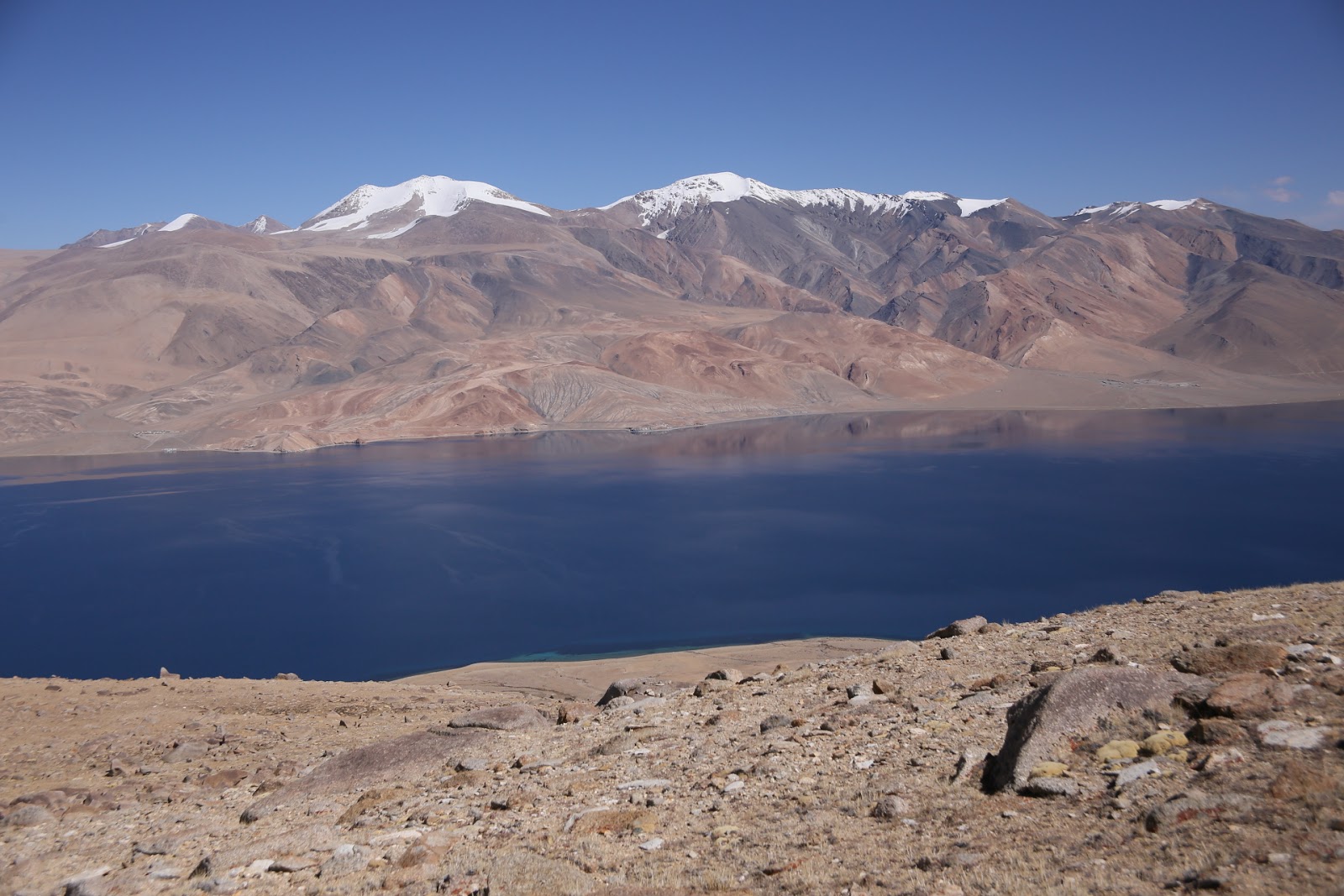
And Tso Moriri was glinting in the morning sun, 1600m below us.
To the south was the highest point, Mentok 1, at 6250m. That was 100m higher than our summit. But over 1.5km away. There seemed little point spending maybe 3 hours going there and returning just to tag another summit with almost identical views.
Perhaps it would have been nice to get to Mentok 1, but since the Mentok /Korzok range is more of an undulating escarpment than a pointy mountain range, there wasn't much reason to go further in one day. To add a bit more to the story,
Mentok Kangri 2 is featured in a few videos on the internet but they show the same peak as the one we climbed. But Namgyal called our peak "Mentok 3", and I thought (according to the map on my GPS) that Mentok 2 was to the north of us and at 50m higher. So I've climbed "a Mentok"... but which one?? As you can see from the photos, the highest point is hardly worth worrying about (unless you are peak bagging) as the whole range is quite even in height, with a difference of 100m at best between summits. And maps of the region all seem to differ slightly. I guess in the end does it really matter? Its not like K2 or anything!
It would take us 6 more hours to return to Korzok, as we planned to walk all the way back to the village that day, so really we didn’t have too much time left for Mentok 1.
No regrets this time, as this summit felt great! Namgyal had my prayer flags that had been blessed in a Puja ceremony in Korzok, so we tied them to the summit and watched as they began fluttering the Buddhist prayers on the freezing cold mountain wind out into the blue space over the lake, towards Lungser and Chamser Kangri.
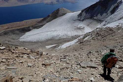
Soon enough, our time at the top was over. And it was very cold too, despite the blue skies! The walk down was as arduous as the climb up, so we used harnesses and a rope for safety.
Loose rocks , steep slopes,descending for what seemed hours on end. There was no easy way out, so it was best to just admire the views and push through it all. Ironically this was the first 6000m peak that I didn’t need to use any real mountain gear for. I didn’t need crampons, double boots or ice axe.Just my trusty Scarpa trekking boots and a trekking pole! I did have the crampons and ice axe with me, but they were not needed.
Mid October in Ladakhis very dry, but just before the snows return. I had found my window this time.I had approached this peak with respect and humility and in return the mountain had been very kind! I was grateful that finally everything had come together to give me a summit success that I had tried so hard to gainbefore.
Persistence had paid off! Again!!So... with that out of the way... time to make another Grand Plan!


Comments
Post a Comment