
|
|
Area/Range |
|---|---|
|
|
36.25241°N / 137.64818°E |
|
|
10466 ft / 3190 m |
|
|
Overview
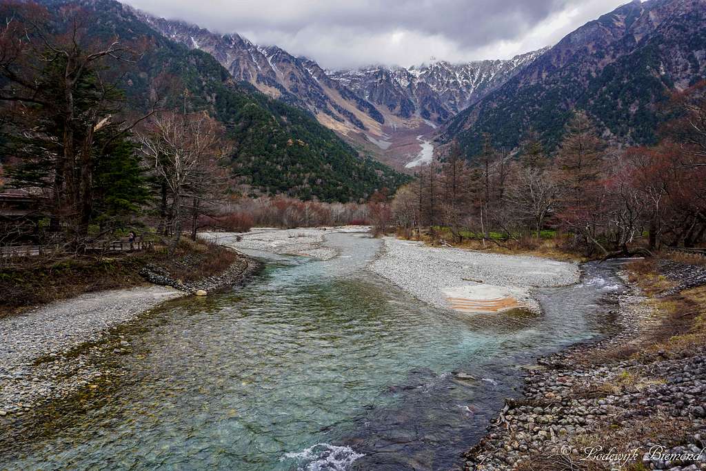
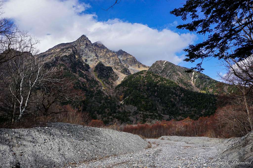
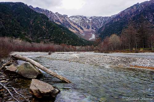
Hotaka Dake (3190m) and the bright colored Azusa river
Kamikochi / 上高地 is a wonderful highland valley located in the heart of the Japanese Alps. When translated, Kamikochi roughly means something like "where gods descend", and I think that says enough already about this amazing place. Kamikochi is the prima attraction of the Chūbu-Sangaku National Park (中部山岳国立公園) and is the perfect starting point for many hikes and climbs in the area. Kamikochi is home to some of the highest mountains in Japan like Yariga Take (槍ヶ岳,3180m) and Hotaka-dake (穂高岳,3190m) and is famous for the bright colored water of the Azusa river. Kamikochi is also home to Macaque monkeys, who can be seen regularly in the valley. Last but not least, Kamikochi has multiple mountain huts, all great starting points for hikes and climbs of the surrounding mountains.
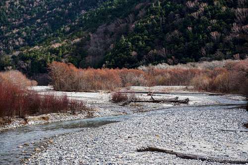
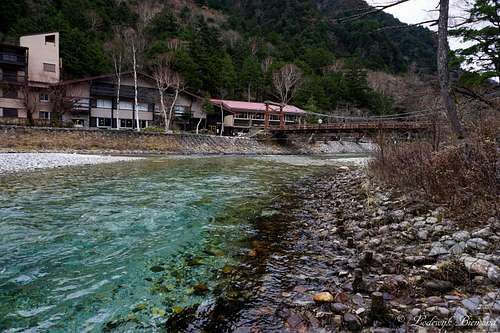
The Kamikochi valley is about 18 kilometers in length and the altitude varies from 1400 meters (above sea level) in the south to 1600 meters in the North. Kamikōchi is bordered in the north by Mount Hotaka, and in the south by Mount Yake, an active volcano. The Azusa River flows through the length of the valley and eventually flows into Lake Taisho in the south. Lake Taishō received its name because it was formed by the eruption of Mt. Yake in 1915, which was part of the Taishō period in Japan.
 Dakesawa Shitsugen Marsh | 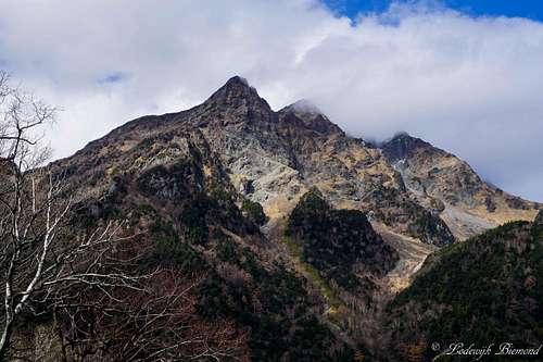 Myojin-dake (2931m / 9616ft) |
Kamikochi is located in the Hida Mountain range, part of the Japanese Alps, in the western part of the Nagano Prefecture. It is located west of Matsumoto and east of Takayama. It has been preserved in its natural state within Chūbu-Sangaku National Park. Furthermore, it is designated as one of Japan's National Cultural Assets, and is on the list of Special Natural Monuments and Special Places of Scenic Beauty. It is sometimes referred to as the "Japanese Yosemite Valley."
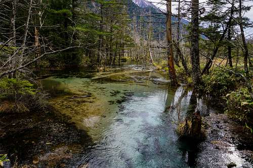
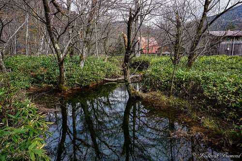
Because of the relatively flat topography of the Kamikochi Valley, marshes and ponds are a common feature, including the Takezawa Marsh, Tashiro Pond and Myojin Pond. The ponds are filled either from snow runoff or underground aquifers (or both), resulting in cold water temperatures, even in summer.
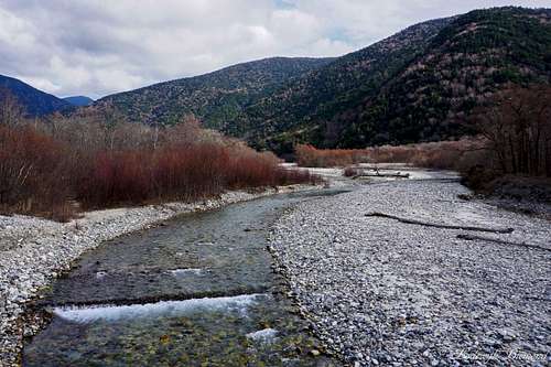
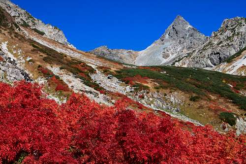
 Colorful trees alongside Azusa River | 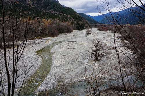 The Upper Azusa river |
For those who want to climb and hike Kamikochi is a perfect starting point. The most popular mountains surrounding the valley are Yari-ga-take (3180m) and Hotaka-dake (3190m). These two peaks are amongst the highest in Japan and are a popular destination for climbers, especially in the summer months. Actually, Hotaka-dake is the third highest mountain in Japan, after Mount Kita (3195m) and Mount Fuji (3776m).
A popular spot in Kamikochi is, for example, the Taisho Pond. This pond is seen as a romantic place where one can be "lured into the world of fantasy", as the Japanese say. The pond has an amazing view of the surrounding mountains including Hotaka-dake. Also popular is the Kappa bashi (Kappa Bridge). This big wooden bridge over the Azusa river is probably the most photographed spot in the area.
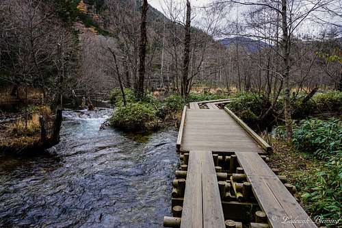
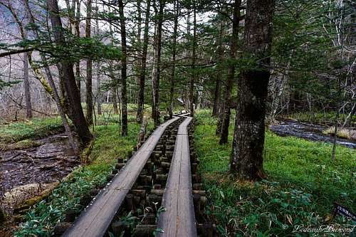 The scenic wooden trail | 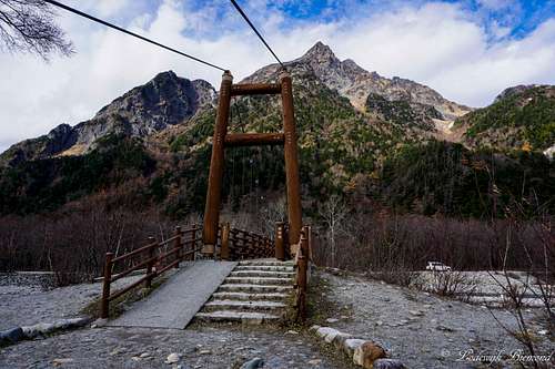 Myojin Bashi bridge |
Opposite to the Azusa river and nearby the Kappa bridge is the monument of British missionary Walter Weston. Weston introduced western style mountaineering to Japan and exposed Kamikochi and the Japanese Alps to the rest of the world. Weston was one of the first persons (after Gowland) to use the name ”Japanese Alps”, which became the official name of the mountain range
If you are visiting Japan, visiting Kamikochi is, in my opinion, a must. In the summer months it can get a bit crowded but remember that 90% of all tourists do not go more than 500 meters from the bus stop, so be sure to take your hiking shoes and you will have a great experience in the Japanese Alps.
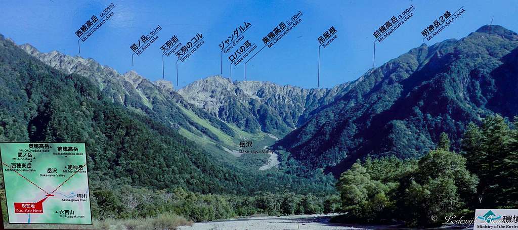
Hotaka Dake Range (3190m) Annotated Panorama
History
Mount Myojin and Mount Mae Hotaka Dake (3090m)
William Gowland, an English goldsmith, was hired, together with a group of western engineers by the Japanese Government. He wrote about his first mountain climbing experience, Climbing Yarigatake, in July, 1877. Gowland was the first ever person to use the term "Japanese Alps" in his article, and it became the common name to refer to the Japanese mountains located in the Nagano prefecture. A couple of years later, an English reverend, Walter Weston, also climbed Yarigatake, and introduced the Kamikochi mountains in his book "Mountaineering and Exploration in the Japanese Alps".
In 1918, the mountain road and trails from Shimashima to Yarigatake were prepared for the visit of his Imperial Highness Prince Higashikuninomiya, who also became a Japanese prime minister in the post war period. After this event, mountaineering became a popular activity in Japan.
 Kappa Bashi bridge | 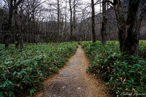 Kamikochi Forest Trail |
After the eruption of Yakedake in June of 1915, the volcanic mud slide dammed the flow of the Azusa River, and created a pond called Taisho Pond. This pond is one of the prime atttractions in Kamikochi to this day.
 Myojin Ike pond | 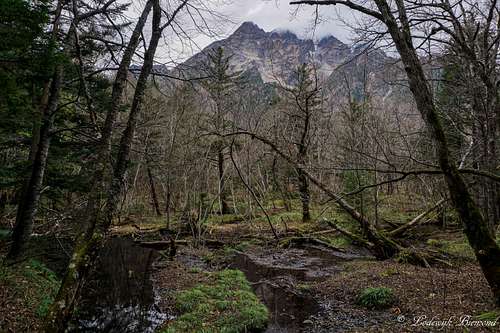 Myojin-dake from the trail to Tokusawa |
1927 became a memorable year for Kamikochi . Ryunosuke Akutagawa, a prominent writer in Japan had introduced Kamikochi and its Kappa Bridge in his wellknown novel "Kappa". In July 1927, Kamikochi was chosen as one of the most scenic spots in Japan along with seven other famous spots. In August 1927, His Imperial Highness Prince Chichibunomiya climbed both Hotaka-dake and Yarigatake from Kamikochi, and this news made Kamikochi instantly famous. After this year, the number of tourists in Kamikochi doubledIn 1934, the Kamikochi area became part of the Chubusangaku National Park.
The Kamikochi valley had to be closed in winter due to the Park regulations, and tourist buses carried many visitors to the Kappa Bridge inside the valley. Every year, the numbers of tourists visiting Kamikochi increased, and a traffic regulation was introduced in 1975. According to the present restrictions, tourists are prohibited to visit Kamikochi by car. Visitors can only access Kamikochi by a bus transfer nowadays. There are plans to connect Kamikochi by railway in the near future.
Trails
Kamikochi Trail Overview Map
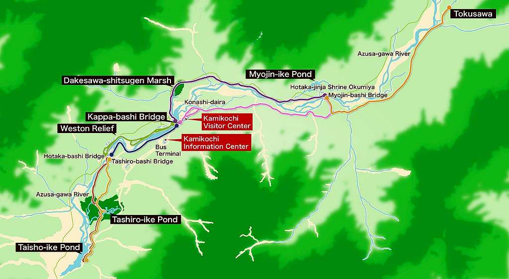
There are multiple trails in Kamikochi. In the following sections I describe some of the trails present in the Park. Also see the map above. Trail I is the pink trail on the map, trail II is the purple trail on the map and trail III is the orange trail on the map (on the right side on the map).
I Kappa-bashi Bridge to Myojin (Left-shore)
 Classic Kamikochi view on Hotaka Dake | 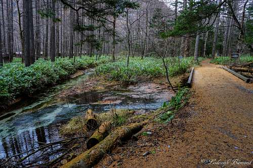 Myojin Left bank Trail |
Distance: 3.0 km Duration: About 60 minutes
The trail along the Azusa River leads from Konashi-daira to the forest. You should have a view of Mt. Choga-take as you progress along this path. Soon you’ll come across traces of volcanic mud flows at Shimoshira-sawa on the bank of Azusa-gawa River. You’ll see some young plants such as willows and alders restoring the forest. Myojin is a short distance from here.II Kappa-bashi Bridge to Myojin (Right-shore)
 Kamikochi River trail | 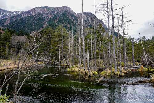 Dakesawa Shitsugen Marsh |
Distance: 3.5 km Duration: About 70 minutes
This trail from Kappa-bashi Bridge passes through the Dakesawa-shitsugen Marsh, and offers views to Dakesawa in front of you. Walk along the Dakesawa stream following the small wooden path/trail through the forest. If you pass through the shrine gateon the left before the Myojin-bashi Bridge, you will arrive at Myojin-ike Pond, otherwise, if you cross the bridge, you’ll come to the River Left-shore Path and can continue to Tokusawa or go back to the Kappa bridge on the other side of the river.
III Myojin to Tokusawa
 The Azusa River from Myojin bridge | 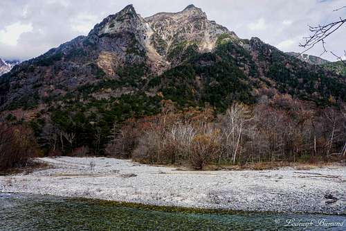 Myojin-dake peak (2931m / 9616 ft) |
Distance: 3.7 km Duration: About 60 minutes
An enjoyable flat trail through the forest. In early summer it is possible to see large outcrops of wind flowers, also there is an old pond on the way at your left. When the path starts to go along the Azusa-gawa River, you are getting close to Tokusawa. At Tokusawa, a campsite is present. The trail is easy (T1/2) and relatively quiet.
Mountains to be climbed
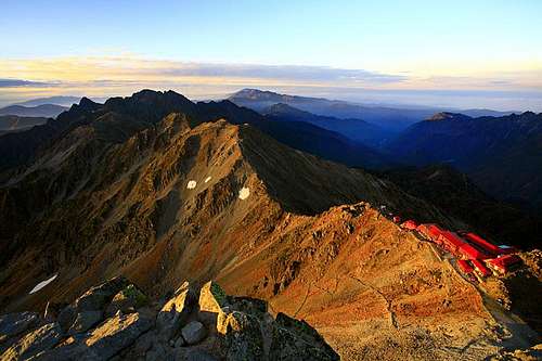 Mount Hotaka Dake (3190m) | Mount Hotaka-dake is the third highest mountain in Japan, after Mount Kita (3195m) and MountFuji (3776m). It also is the highestin Nagano and Gifu prefectures. Hotaka-dake is a popular objective forclimbers. Many of them start their climb from Kamikochi. See the SP-page ofHotaka-dake for more information about this peak. |
 Mount Yariga Take (3180m) | Mount Yariga-take is often referred to as Mount Yari. This peak is with is 3180meters among the highest peaks in Japan and is locates to the north of itshigher neighbor Hotaka-dake. This mountain is famous because of it’s amazingpyramid shaped summit. Mount Yari is also a popular objective for climbers.Many of them start their ascent from Kamikochi. See the SP-page of MountYari for more information about this peak. |
Mountain Huts
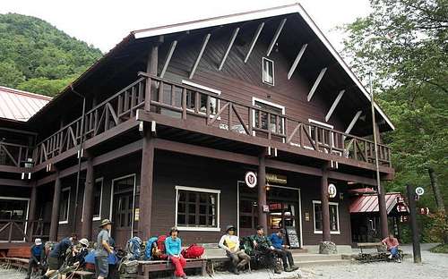 Tokusawa Mountain Hut | Tokusawa Lodge and campground is located in theTokusawa area of Kamikochi. It is surrounded by nature and offers a great view of Mt.Hotaka. It takes about twohours on foot from Kamikochi Bus stop. (about 4.35miles). Tokusawa is a popularbase camp for climbs of the surrounding mountains. Official Website : Click Here |
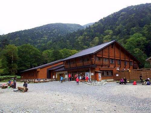 Yokoo Sanso Hut | Yokoo - Sanso is a popular base camp for a great number of mountain climbers andtrekkers who are destined for Yarigatake Peak and Hotaka Mountain Range, and islocated at inner-Kamikochi in the Chubusangaku National Park. Yoko-o Sanso is11 kilo meters (3hours/walk) from one of the most scenic spots “Kamikochi”. Official Website : Click Here |
How to get There

Kamikochi Route Map
Access by train and bus: Take the Matsumoto Dentetsu Line from Matsumoto Train Station to Shin-Shimashima (30 minutes), followed by a bus ride to Sawando (60 minutes). You could also take a bus to Sawando/Hiraju directly. It is a 90 minute journey and you can meet the bus in front of the Matsumoto bus terminal located across the street from Matsumoto JR train station. The last option is preferable in my opinion. The bus ride goes directly to Sawando/ Hiraju and offers great views of the Japanese Alps. Very recommended! The same direct bus connection starts from the bus Terminal opposite to the Train station in Takayama. From here it is a 75 minute ride to Hiraju, from where you can get a bus or Taxi into Kamikochi.
Access by car: The road to Kamikochi is closed to private cars just below the last tunnel at Sawando. You can park your car at Sawando for 500 yen a day, and catch a bus or taxi into the park. The parking outside of Kamikochi is about 50 minutes by car from Matsumoto JR train station. When coming from Takayama it will take up to 60 minutes by car to get to Hiraju. From here you can take a bus or Taxi into the park.
This website describes all access routes to Kamikochi very well. Be sure to check this if you are planning to go to Kamikochi.
Red Tape
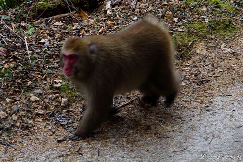
Japanese Macaque monkey
Kamikochi is closed during the winter months. In 2016 the park was opened from April 15th - November 15th.
Regulations:
Don't Feed & Disturb! Do not disturb or feed birds, insects, fish or other wild animals.
Don't Harm! Do not harm or damage wild flowers and plants.
Don't Dump! Carry all your garbage home with your splendid memories.
Weather & Climate

Kamikochi Climate Map
External Links
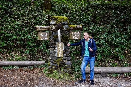
Road sign near Myojin
Kamikochi Official Website
Japan Alps Kamikochi Website
Japan Travel Guide Kamikochi
Matsumoto Welcomes You: Kamikochi
Go! Nagano Kamikochi Website