Toggle navigation
Mountains
Routes
Images
Trip Reports
Forum
What's New
People
Areas & Ranges
Articles
Trailheads
Canyons
Huts & Campgrounds
Albums
Logistical Centers
Fact Sheets
Lists
Custom Objects
Gear
Plans & Partners
WELCOME TO SUMMITPOST
SIGN IN
REGISTER
Liberty Ridge
Additional Parents
Liberty Cap Beating #1: Liberty Ridge
Image
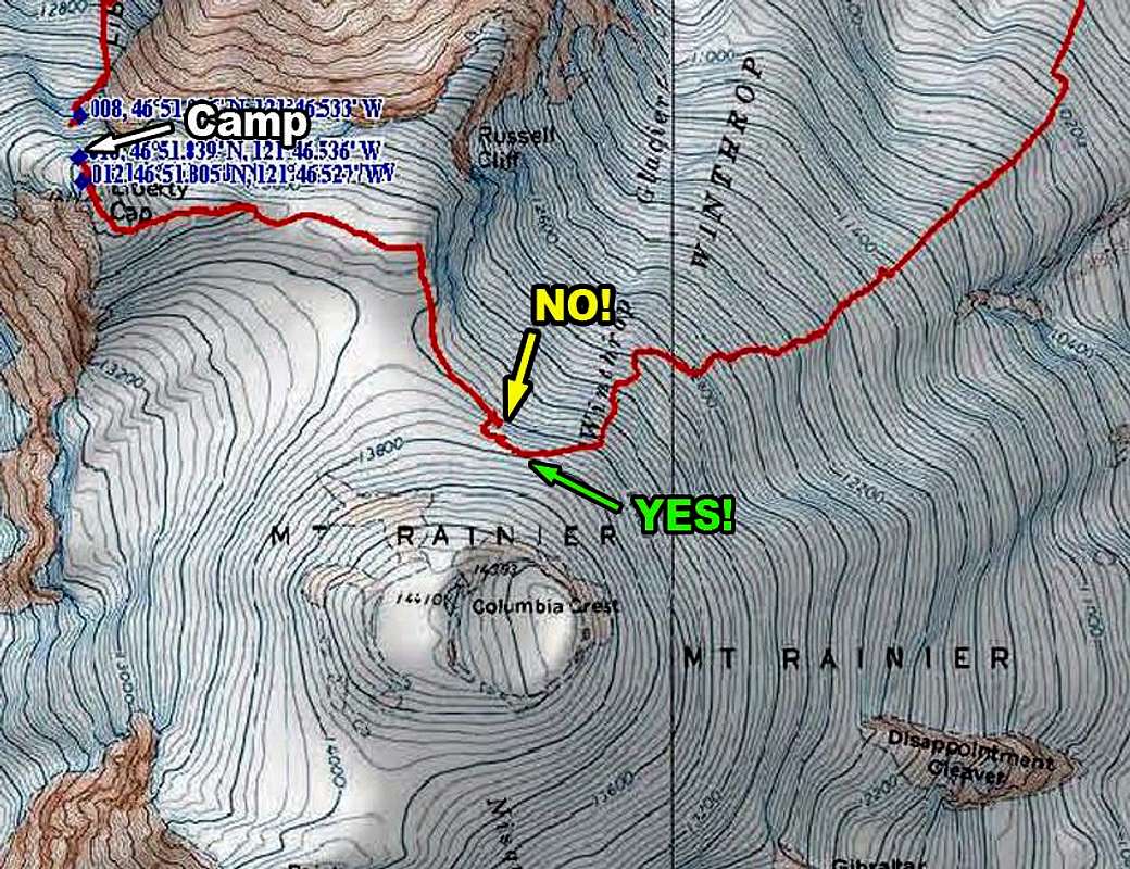
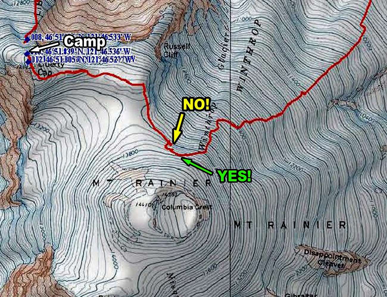
GPS Track of Our Liberty Cap Crossing in the Whiteout
View High-Resolution Image
GPS Track of Our Liberty Cap Crossing in the Whiteout
July 18, 2011 - Our descent path and some course corrections made to avoid the icedall atop the Winthrop Glacier. This path might be more obvious in better visibility.
« PREV
NEXT »
PellucidWombat
on
Sep 2, 2011 7:33 pm
Comments & voting
Other parents
Lat/Lon:
46.86520°N / 121.775°W
Image ID:
743241
4130 Hits
72.08
% Score
2
Votes
Log in to vote
Comments
Post a Comment
Viewing: 1-1 of 1
Bezoar Goat
-
Mar 20, 2013 1:30 pm - Voted 10/10
Gracias
VERY helpful guys, thank you!
Viewing: 1-1 of 1
to post!
Don't have an account?
Liberty Ridge
(Route)
« PREV
Viewing
#54 of 56
GALLERY
NEXT »
PellucidWombat's Image Gallery
« PREV
Viewing
#1902 of 2324
GALLERY
NEXT »
Liberty Cap Beating #1: Liberty Ridge
(Trip Report)
Loading....
×
You need to login in order to vote!
User Name
Password
Remember me
Forgot your password?
Log me out when I close my browser.
Keep me logged in all the time.
sign in as a user
Don't have an account?
Register now for FREE
Rating available
Suggested routes for you
People who climb the same things as you
Comments Available
Create Albums
Register Here


Comments
Post a Comment